On the Map with Brian Beard
Meet Brian Beard, an Ottawa high school geography teacher who's been bringing maps to life in his classroom for over a decade. Using ArcGIS, he turns lessons into real-world explorations helping students make powerful connections in their community and understand Canada in new and meaningful ways.
Find out more about Brian including how he supports fellow geography teachers and the types of ArcGIS activities that engaged his students in learning.
When were you first introduced to geographic information systems (GIS)?
My journey with GIS began at an OAGEE conference, I think in 2012. Since then, I’ve been continuously finding new ways to incorporate it into my teaching. It started with ArcView and then I moved to ArcGIS Desktop and now I use ArcGIS Online and ArcGIS apps.

Brian is an avid ArcGIS user who finds opportunities for his students to try different ArcGIS tools to learn about Canada, the World, and their community.
What are some of the activities/projects you have done with the students?
ArcGIS Online gives my students the opportunity to do real-world geographic inquiry. It allows them to take ownership of their own learning, and it provides opportunities for them to have engaging discussions about the world around them.
Exploring Strand E - Liveable Communities from the Exploring Canadian Geography course, my grade nine students used an Analysis tool called Generate Travel Areas to create a layer that showed the area they could access within a 15-minute walk from their home. The students moved on to ArcGIS Survey123 to collect data on the land use type found within that 15-minute zone. Finally, they used ArcGIS Business Analyst to determine various statistics about their community. They explored the key features of a 15-minute community, examined the City of Ottawa’s plans to promote this model, and discussed what changes would be needed to transform thei own neighbourhoods into walkable, self-sufficient communities.
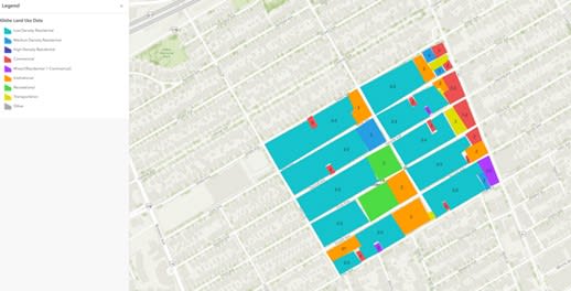 Land use data map created by a grade 9 student in Brian’s class.
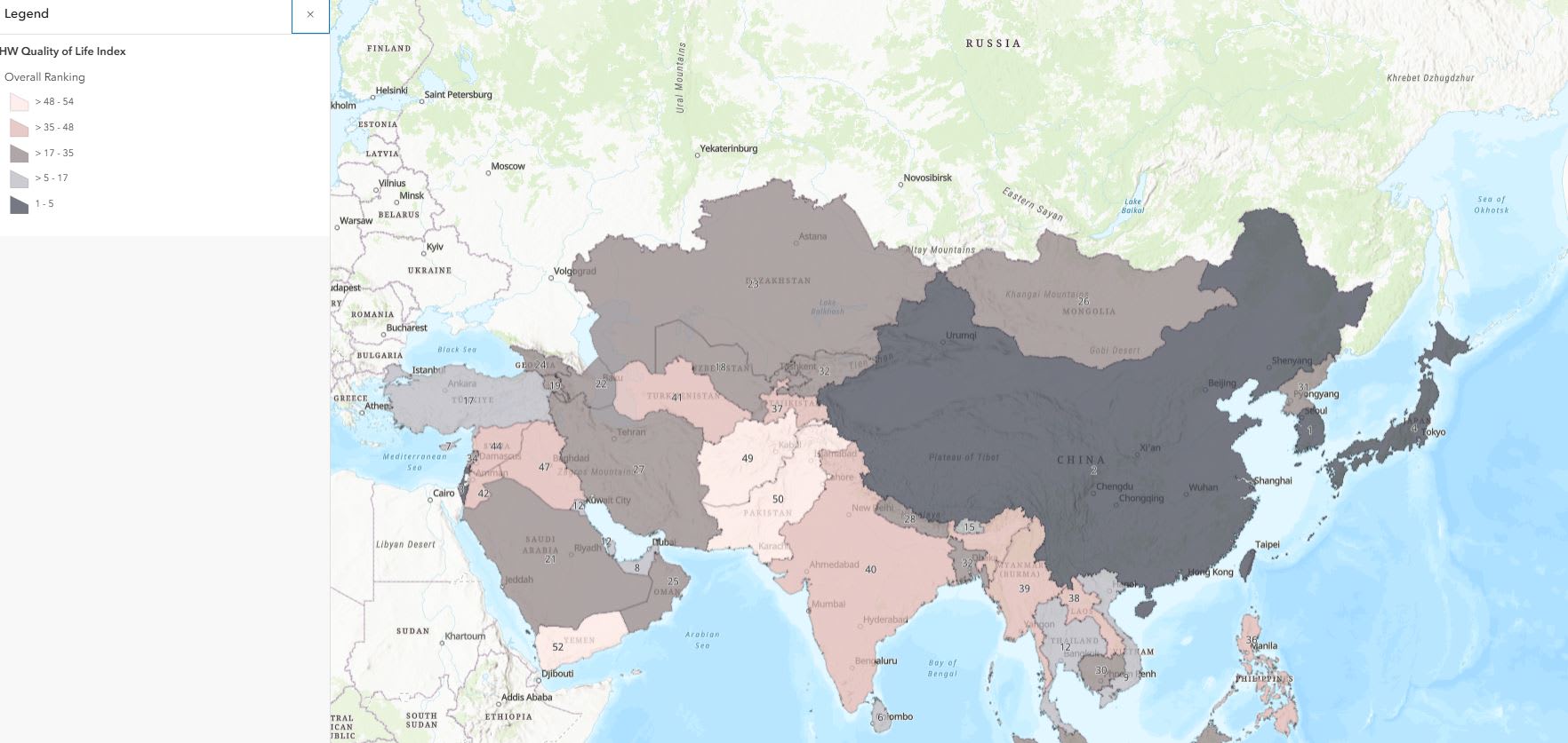
In my International Baccalaureate (IB) geography class, students produced thematic maps in ArcGIS Online to show the results of a Quality of Life index they created to make comparisons about countries in a select part of the world.
“This year, I learned how to use ArcGIS to make interactive maps that show patterns and trends in Canada and globally. It helped me understand geography better and feel more confident using technology.”- Sarah, student
Other activities the students worked on include:
- ·Exploring landform regions in ArcGIS Online to gain a better understanding of the geography of Canada.
- Making connections between crime and demographics in Ottawa, Ontario through mapping. This is connected to Strand D - Changing Populations in the grade nine geography course.
- Mapping Home Depot locations using ArcGIS Business Analyst to understand site selection and demographics of an area.
How are you supporting fellow geography teachers in using GIS?
As a GIS Ambassador and the OAGEE GIS Technologies representative, I support the use of GIS in K-12 education by facilitating teacher workshops and producing resources that they can use in their own classrooms.
This past year, I facilitated an introductory ArcGIS workshop for teachers at my board on behalf of Esri Canada’s K-12 group. I am happy to help where I can.
What’s next with ArcGIS?
This Fall we will be doing an Urban Heat Island study using ArcGIS tools. We will be using ArcGIS Survey123 to map and collect data on air and surface temperature, land use, tree inventory, and mode of transportation used in the research area.
Thank you, Brian, for sharing your experience with us. We wish you well in the upcoming school year! Connect with Brian @brianbeard.bsky.social.
Inspired to get started with ArcGIS Online?
K-12 educators can sign up today at k12.esri.ca. Begin your journey with the following resources:
Let’s get started with ArcGIS Online
Self-guided learning for K-12 educators
ArcCanada Atlas Activity Collection
Explore and understand national and global geography, history, and culture through interactive activities and create maps.