GeoAI in Action: My Rotation with Esri Canada’s Education & Research Team
Every step in a career offers new lessons, but some experiences stand out more than others. My time with Esri Canada’s Education and Research team has been one of those moments — it not only deepened my skills in GeoAI but also reshaped how I see the future of geospatial technology. Join me as I share how this rotation became a turning point in my approach toward my career.
I joined Esri Canada in May 2024, right after my graduation, as an Associate GIS Analyst through the Associate GIS Professional Program. This program is designed for recent GIS graduates who are passionate about geospatial technology and eager to launch their careers in the GIS industry. As part of this rotational program, associates have the opportunity to work across various departments at Esri Canada and gain hands-on experience with the full suite of ArcGIS products.
One of my rotations was with the Education and Research department from April to August 2025. With my multidisciplinary background in urban planning, design, geography, and GIS — and my genuine interest in research — this rotation felt like the perfect match. During my time in this department, I had the pleasure of working with a team of supportive and inspiring colleagues. We connected regularly through weekly team meetings, one-on-one check-ins, and even in person at Esri Canada’s Inspire 2025 — an annual event held this year in the scenic Blue Mountain. It was a fantastic opportunity to meet the team and share ideas in a beautiful setting.
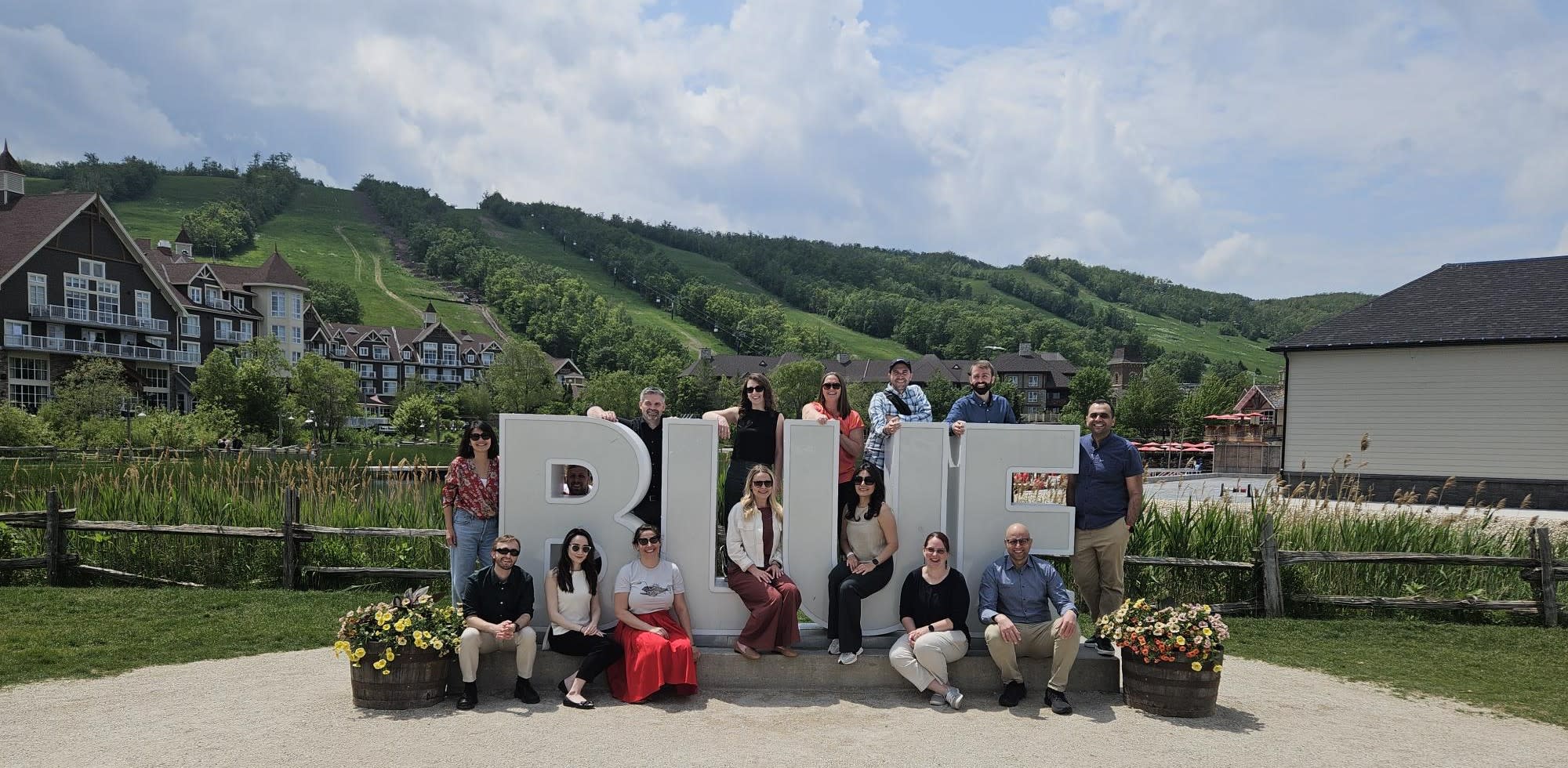
Education and Research group photo at Inspire 2025
While I had some GeoAI experience during my MSc Geography studies at the University of Calgary, it was during my rotation with the Education and Research department that I truly began to understand the broader potential of GeoAI. Through hands-on collaboration, exposure to real-world projects, and learning from experienced colleagues, I gained new insights into how GeoAI can be applied to solve real-world challenges—and how I could shape my career around it.
As I wrap up my rotation with the Education and Research department, I’d like to take a moment to reflect on some of the GeoAI projects I contributed to during this time.
From Graduate Project to GeoAI Public Tutorial
When I began my rotation with the Education and Research department, there weren’t many active projects I could immediately jump into. In hindsight, this turned out to be a hidden opportunity. I used the time to revisit a project I had developed during my MSc studies.
As part of my research, I worked with LiDAR data to extract and map small urban features—such as benches, streetlights, and fences—using ArcGIS workflows to train deep learning models. While ArcGIS Living Atlas offers a variety of pretrained models, they often don’t cover niche or fine-scale urban objects. This gap led me to develop a custom model during my graduate studies to detect and classify these features from LiDAR point clouds.
I remembered how challenging it was to find comprehensive tutorials or resources that could guide students through this workflow from scratch. Most documentation was scattered or not comprehensive enough for a student. So, I decided to turn my experience into a detailed, accessible tutorial that walks users through every step of the process—from foundational concepts to implementation.
The result is a hands-on guide titled “LiDAR Semantic Segmentation Using Deep Learning”, available through Esri Canada’s Higher Education Resource Finder. This tutorial provides a step-by-step walkthrough for training a custom PointCNN model in ArcGIS Pro using the ArcGIS API for Python to classify urban light poles from LiDAR point clouds, and offers a solid foundation for building custom object detection models from point cloud data. It’s especially useful for students, researchers, and GIS professionals interested in GeoAI, 3D data, GIS-based urban solutions.
It is worth noting that this resource wouldn’t have come together without the valuable input, thoughtful feedback, and guidance from my GeoAI colleagues the Education and Research department, Mohamed Ahmed and Alex Smith. Also, after publishing the tutorial and sharing it on LinkedIn, I was thrilled to see it receive positive attention from the GIS community. It’s been incredibly rewarding to watch others engage with a project that began in a university lab and evolved into a public resource.
CMHC Change Detection Project
Another fulfilling experience during my rotation in the Education and Research department was contributing to a national-level GeoAI initiative led by the Canada Mortgage and Housing Corporation (CMHC). The project aims to modernize CMHC’s Starts and Completions Survey by leveraging remote sensing and GeoAI for image classification and change detection. The ultimate goal is to automate the identification and validation of newly built residential areas, which could significantly reduce the need for CMHC’s manual, field-based operations.
While the broader team explored various imagery types and workflows, my focus was on testing PlanetScope 8-band imagery (~3 m resolution) for change detection. I assessed its suitability for identifying newly constructed buildings using imagery from Gatineau and Regina from consecutive years as test cases and consequently identified four ArcGIS-based workflows for change detection, ranging from Normalized Difference Built-up Index (NDBI) based raster analysis to pixel-based normalization, unsupervised and supervised classification approaches.
Below is a sample result from one of the workflows, which involved calculating the NDBI, normalizing the raster datasets, and applying the Change Detection Wizard in ArcGIS Pro. Green pixels indicate areas of change between the two time periods:
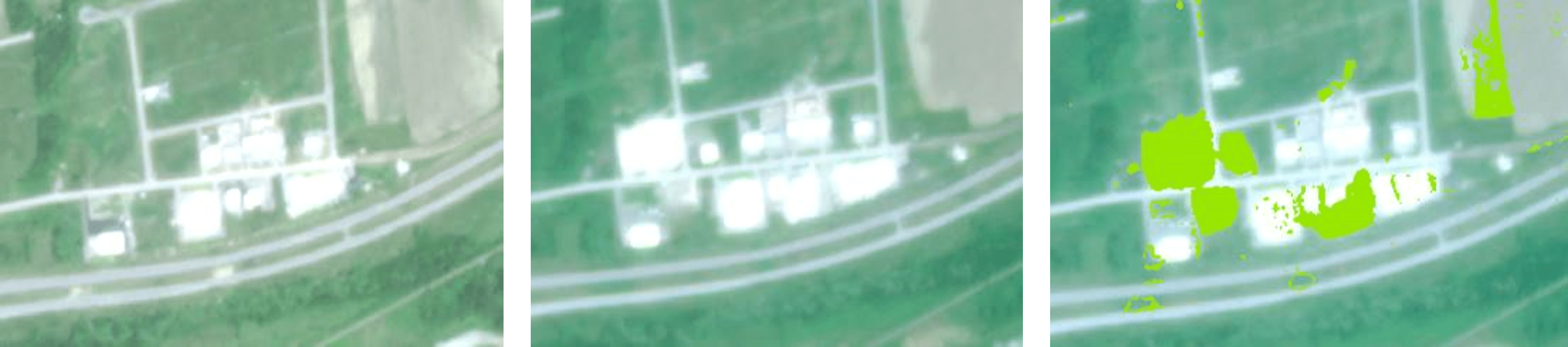
Change detection: green pixels (right) show land changes for a part of Gatineau from June 2023 (left) to June 2024 (middle)
I had the opportunity to present this work to CMHC alongside the rest of the team. Our findings helped inform the next steps of the pilot project by emphasizing the importance of resolution-aware modeling, robust preprocessing, and hybrid validation methods using ArcGIS. It was inspiring to see how GeoAI and remote sensing can streamline traditionally manual operations, making them more efficient, scalable, and aligned with data-driven decision-making.
Looking Ahead
My time with the Education and Research department has been more than just a rotation — it has been a turning point that reshaped how I see GIS and GeoAI. I’ve come to appreciate them not only as technical tools, but as powerful ways to better understand and improve the world around us. This experience has given me fresh perspective, renewed purpose, and plenty of inspiration for the road ahead.
To the Education and Research team: thank you for welcoming me, supporting my ideas, and giving me the space to grow. I look forward to staying connected and continuing this journey of learning together.