New Living Atlas Content: Real-Time Provincial Road Traveller Information
Enter contentive feature services displaying road conditions, traffic incidents and construction projects are now available in the ArcGIS Living Atlas of the World Canada Edition.
With construction season in full swing, and winter just around the corner you might be thinking there is no escaping the unexpected traffic delays, but what if I told you there could be a solution? That is where Esri Canada’s Provincial Road Traveller Information Live Feature Services come in. With increased infrastructure projects across the country and unprecedented weather conditions every season, the need for up-to-date travel information has never been more important. Using data provided by-the province’s 511 service, these live feature services are updated every 15 minutes.-
Currently the following provincial road traveller information live feature services are available, other provinces are coming soon. -
Each feature service consists of a variety of layers depending on what data that province’s 511 service collects. -
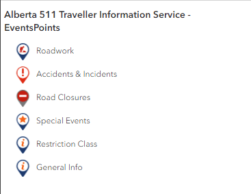
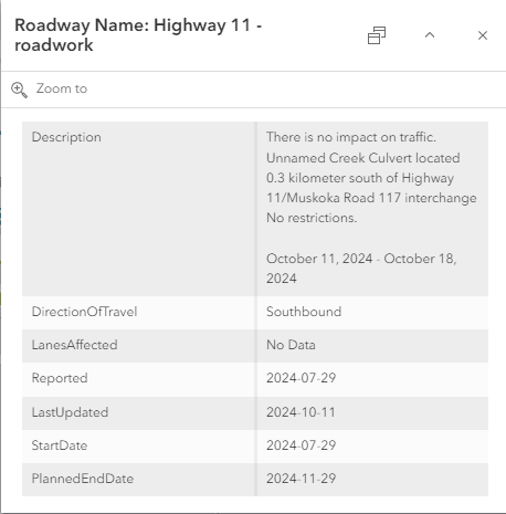
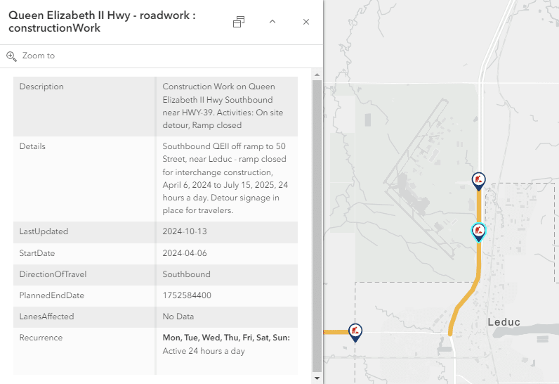
The event points layer provides point data on road events such as-accidents & incidents, road closures, construction and general information. Each feature includes details on the event type, when it was last updated, and the direction of travel it is impacting. For planned events, such as road closures and roadwork a start date and planned end date are provided along with a recurrence schedule. -
For certain provinces an events lines layer is available, this layer corresponds to the events points layer and provides line data showing what road segment is affected by the event. This could be what road segment is currently experiencing road work or what section of the road is closed due to an accident.
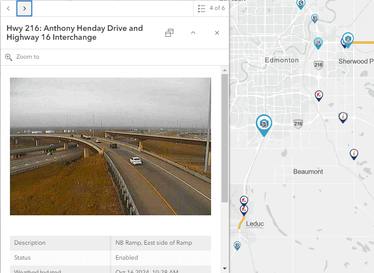
A traffic camera layer is available for certain provinces providing details on its location and the latest photo taken so you can see in near real time what the traffic conditions are in the area.
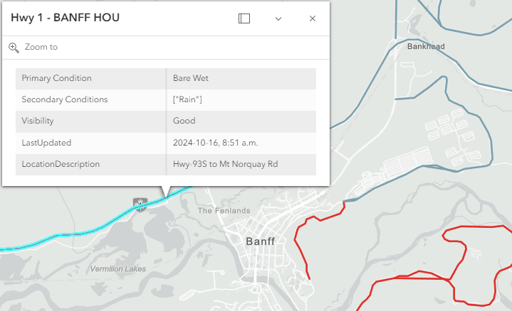
The road conditions layer is essential as winter is fast approaching, it provides details on the conditions of the road, whether it is bare and dry, wet, or snow covered and what the visibility is of the road in the current weather conditions. -
 -
-
We hope you can leverage these new Provincial Road Traveller Information Live Feature Services, and we look forward to seeing how your organization incorporates them into your workflows. Any feedback you have on the new live feature services would be greatly appreciated, please feel free to leave a comment on the item’s ArcGIS Online page or email our Living Atlas Curator (livingatlascurator@esri.ca).