It’s time to recreate your Classic Esri Stories in ArcGIS StoryMaps
It’s time to recreate your Classic Esri Story Maps in ArcGIS StoryMaps as the classic stories will be retired at the beginning of 2026 and removed from ArcGIS Online. After this time, these stories will no longer be accessible.
Over a decade ago, our group began the journey of creating a collection of relevant and interactive resources using various Classic Story Map templates. They included templates that you may remember, such as Cascade, Map Journal and Map Tour to name a few. In 2019, the current ArcGIS StoryMaps was born!
We understand that many of you, like us, have created valuable resources using Classic Story Maps. That’s why we encourage you to start recreating these stories in ArcGIS StoryMaps—taking full advantage of its modern features and enhanced capabilities. Updating your Classic Story Maps will help you continue providing your students with interactive, relevant, and impactful resources.
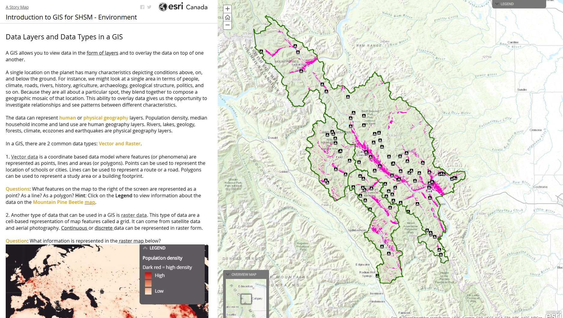
The Introduction to GIS for SHSM- Environment was originally created in the Classic Esri Story Maps – Map Journal template (Shown in the screenshot above). This will still be available after Q1 in 2026, but in the ArcGIS StoryMaps format and will have a different URL than the original. See the image below.
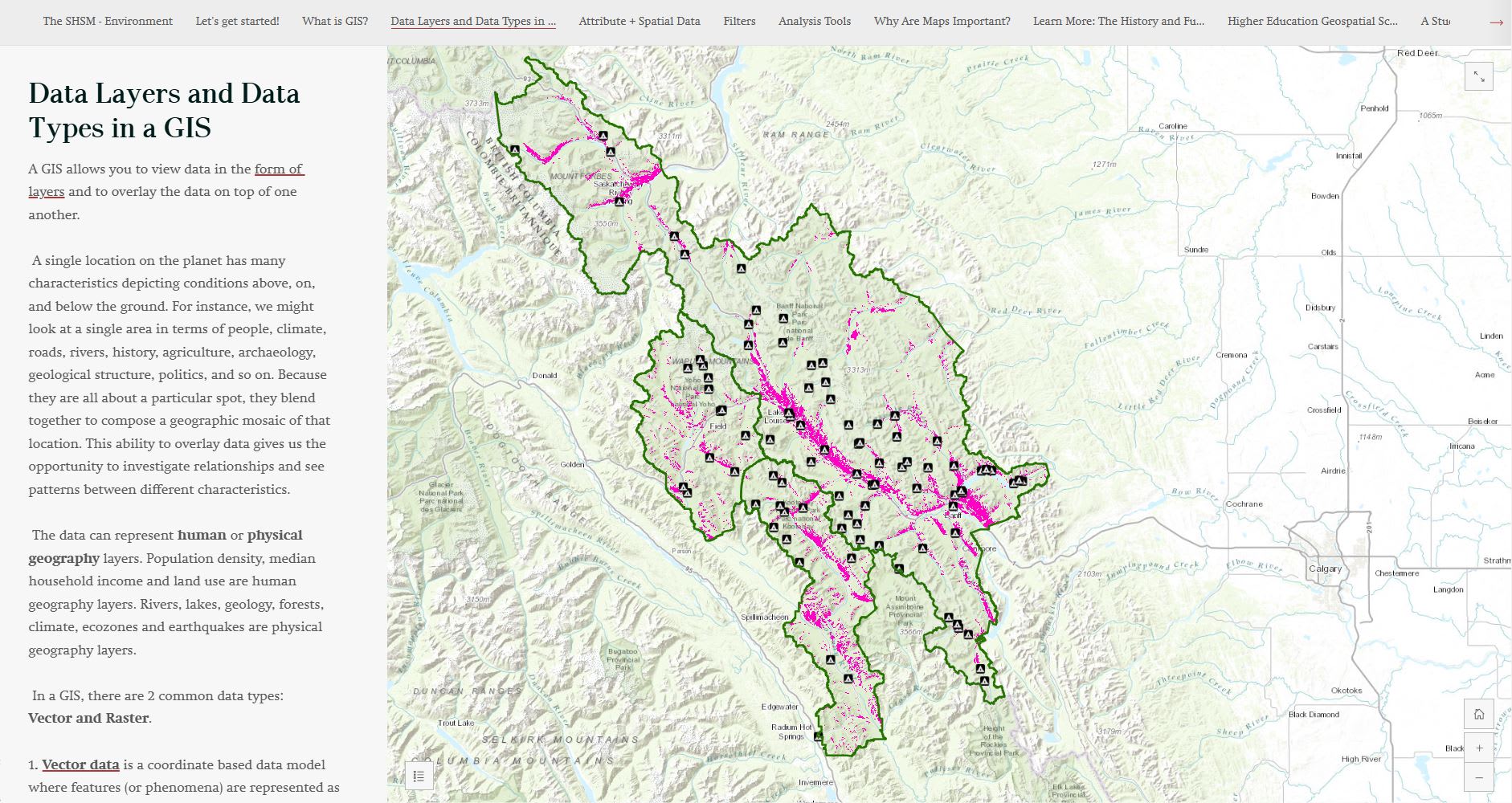
This is the Introduction to GIS for SHSM- Environment in the ArcGIS StoryMaps version. This is an example of an updated Esri Canada K-12 resource.
Resources for recreating your stories in ArcGIS StoryMaps
Several resources are available from the Esri StoryMaps team to support updating your own resources:
This ArcGIS Blog post provides short videos showing you how to “mimic” the classic templates in ArcGIS StoryMaps. This will make your adventure in updating much easier.
The videos show how you can recreate the most popular stories. Here’s a glimpse:
The Cascade template from Esri Story Maps can be reproduced with ArcGIS StoryMaps using the Sidecar - an immersive block – you would select the Floating option.
The Map Journal template from Esri Story Maps can be reproduced with ArcGIS StoryMaps using the Sidecar - an immersive block – you would select the Docked panel option.
Moving to ArcGIS StoryMaps
This resource provides detailed information on moving your classic stories to the current ArcGIS StoryMaps. Note: This was published in July 2019 and has been updated several times. The most recent update was in December 2022.
What’s new with ArcGIS StoryMaps?
Find out what’s new about ArcGIS StoryMaps from the latest update. In December 2024, interactive elements, like charts, were added to enhance the stories you tell.
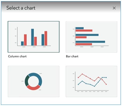
You can now increase the visual power of your ArcGIS StoryMaps by including charts!
ArcGIS StoryMap Templates (Beta) from the August 2024 update
To streamline the storytelling process, you can create a template for students to use in building their own StoryMaps. Whether it’s for a final project or presentation, the template ensures students include essential elements like maps, text, and videos in their StoryMap.
To begin creating a template, sign into your account in ArcGIS Online, go to the Apps picker, select ArcGIS StoryMaps and then select Create template (Beta).

Templates help to ensure students add the elements you want them to include in their storymap.
Learn more about templates and discover how you and your students can create a storymap from them.
Are you a K-12 educator who is new to ArcGIS StoryMaps?
The Discover StoryMaps tutorial will guide you and your students in creating your first one.
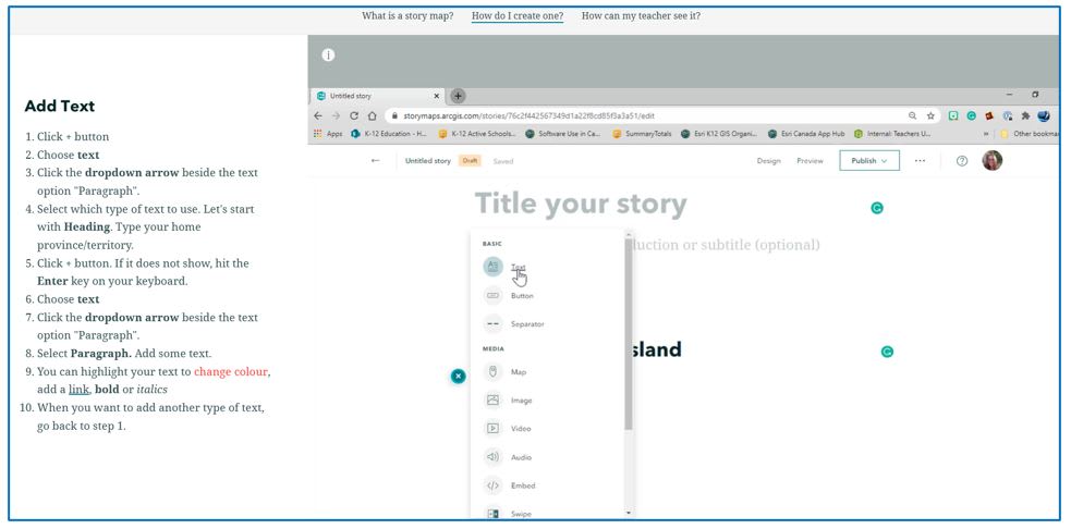
This screenshot from the Discover Story Maps tutorial shows you how to add text to your ArcGIS StoryMap.
Happy Mapping!
Explore more ArcGIS resources on the Esri Canada K-12 Resource Finder.