The Ultimate ArcGIS Checklist for K-12 Educators in 2025
With 2024 setting on the horizon, let’s kickstart 2025 with a game-changing checklist for K-12 educators! In the New Year, it's time to bring the world of mapping and spatial thinking into your classroom with ArcGIS. Whether you're new to ArcGIS or looking to expand your skills, this list will help you seamlessly integrate it into your teaching to boost student engagement and deepen learning. Don't miss out on these exciting opportunities for growth!
Let’s dive into the 10 things to do in 2025:
1. ✔ Move over to the current Map Viewer now!
We know many educators are still using the Map Viewer Classic in their classes. We encourage you to start using the current Map Viewer as soon as possible. Here’s help – use the Map Viewer resources to get you started.
The final update of ArcGIS Online to include Map Viewer Classic will be in Q4 2025.
Learn more about Map Viewer Depreciation.
2. ✔ Try an ArcCanada Atlas activity
Explore and understand national and global geography, history, and culture through interactive activities and create maps.
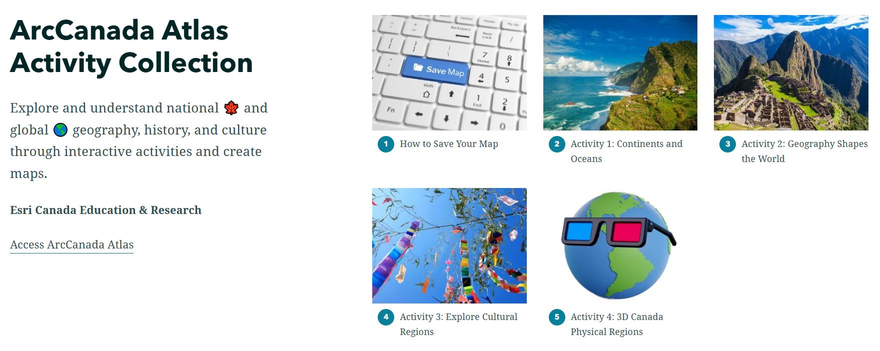
ArcCanada Atlas Activity Collection offers fun and educational activities for your students.
3. ✔ Get Started with Map it in Minutes
In this tutorial, you will learn the basics of ArcGIS Online by completing six activities, each designed to take approximately six minutes to complete.
Activity 1: See Your World 👀
Activity 2: Measure & Mark Your World 📏
Activity 3: Explore Your World 🔎
Activity 4: Expand Your World 💥
Activity 5: App Your World 💻
Activity 6: Create Your World 🌎
4. ✔ Transform Web Maps into Interactive Learning Tools
With this resource, you'll learn how with your ArcGIS Online account, you can use ArcGIS Instant Apps to create engaging, customizable apps from existing web maps, making your lessons more interactive for students.
5. ✔ Integrate Climate Change resources
We have created an activity and three lessons that cover Climate Change related topics.
Mapping the Future: How GIS Tackles Climate Change
In this activity, explore how GIS empowers us to understand, mitigate, and adapt to climate change for a more sustainable future.
Urban Trees: Battling Heat, Climate Change, and Crime
In this lesson, students will use ArcGIS Online to analyze and identify optimal locations for planting public trees in Windsor, Ontario to support the goal of a healthier and more sustainable city for its residents. Your assessment will consider factors such as land surface temperature, existing tree coverage, population density, heat vulnerability index, and incident reporting.
Invasive Species: Emerald Ash Borer
In this lesson, you will use ArcGIS Online to explore, assess and analyse tree data related to the EAB issue in Oakville.
Heat and Cool Islands
In this lesson, Students will explore and identify the elements of urban areas which can affect the temperature and create heat island and cool island effects.
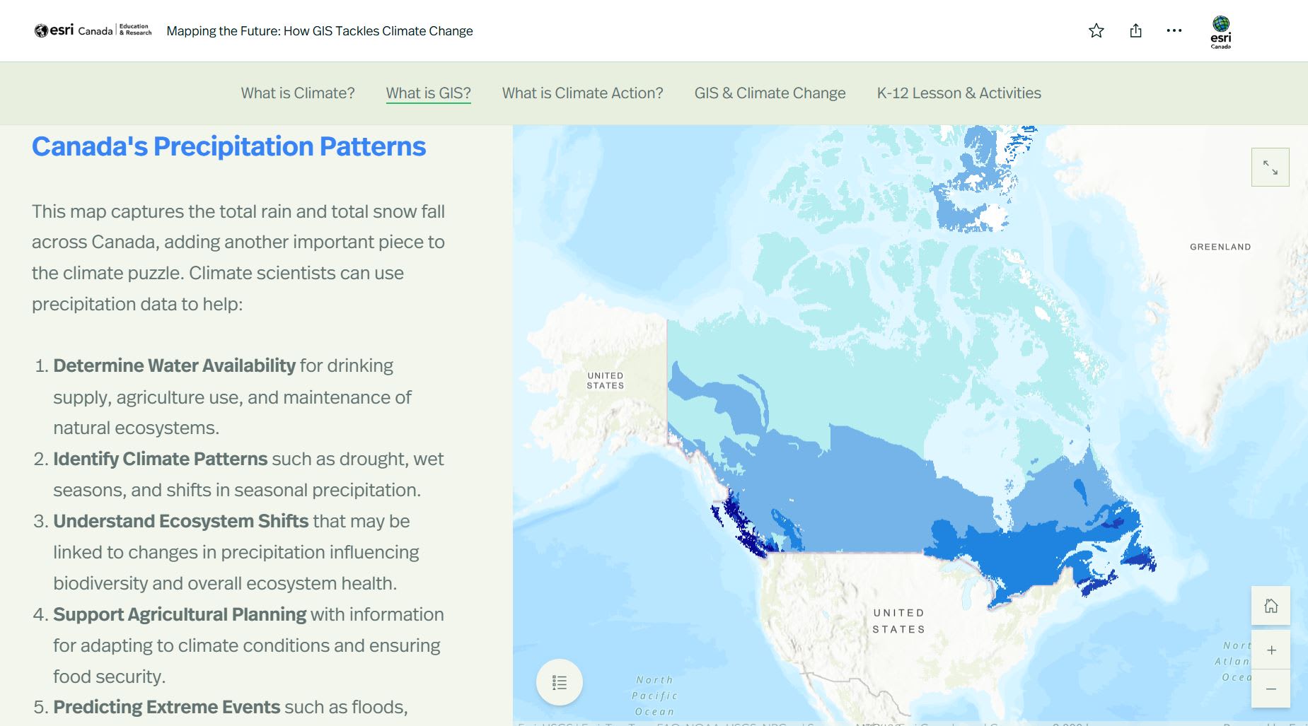
In the activity - Mapping the Future: How GIS Tackles Climate Change, students will interact with maps that cover topics such as Canada’s Precipitation Patterns (shown above) to visualize and analyse physical patterns.
6. ✔ Discover the Career Path Series
With this resource, your students can explore the world of Geographic Information Systems (GIS), showcasing its vast applications across various careers and industries, and dive into hands-on ArcGIS Online lessons.
7. ✔ Try a Partner in Education resource
Explore ready-to-use teaching and learning resources containing maps, apps, and data created by our Partners and supported by Esri Canada K-12 Education.
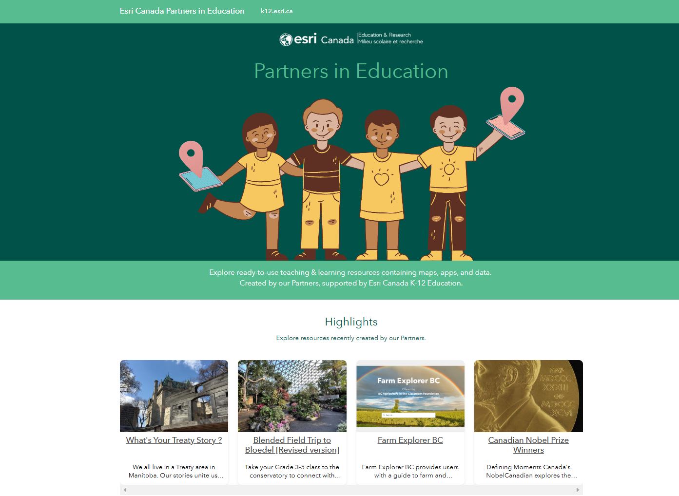
Looking for more resources? Try out a partner resource.
8. ✔ Pay it forward by sharing
Share the video “Can a billion maps change the world” to let others know about the power of GIS in understanding issues happening in our world and how we can make informed decisions to tackle the problems.
9. ✔ Empower your students with GIS
Introduce students to GIS and to inform them of the possibilities with the GeoMinds resource. They can chart a course to the future, where GIS knowledge is not just an asset but a gateway to innovation and career excellence.
10. ✔ Get Inspired!
Check out our On the Map blog series that highlights K-12 educators, partners in education, GIS Ambassadors and students in their ArcGIS journeys.
Do you have a question?
Contact us at k12@esri.ca.
Wishing you a very Mappy Holiday Season from our family to yours! See you in 2025!

K-12 group at Esri Canada: From Left to Right – Tatum Pascal, Arabelle Sauvé, Angela Alexander, Susie Saliola, and Jean Tong.