Land Stewardship in Indigenous Communities: GIS for Anishinabek Nation
Stewards of the land unite with mapping technology in the Anishinabek Nation, which comprises 39 distinct member First Nations, spanning diverse landscapes across Ontario, Canada. At the core of this Nation lies a robust dedication to preserving cultural heritage, nurturing environmental stewardship and managing data effectively through geographic information system (GIS) solutions.
Rhonda Gagnon, manager of lands and resources, has dedicated over 17 years to the Anishinabek Nation (AN). Rhonda oversees land, water, and resource management for 39 member First Nations (FNs) with an approximate combined population of 65,000 citizens. Her GIS journey reflects a unique blend of Western and Indigenous science, bridging tradition and technology.
As a Master’s graduate in Environmental Science and holding multiple roles, including former AN Policy Analyst, Anishinabek Community Stewardship Leader and published author, her diverse responsibilities highlight her steadfast dedication to future generations. Beyond her professional roles, Rhonda's profound connection to the land extends to her personal life, where she finds solace in activities like gathering medicinal herbs and fishing on the tranquil waters of Temagami.
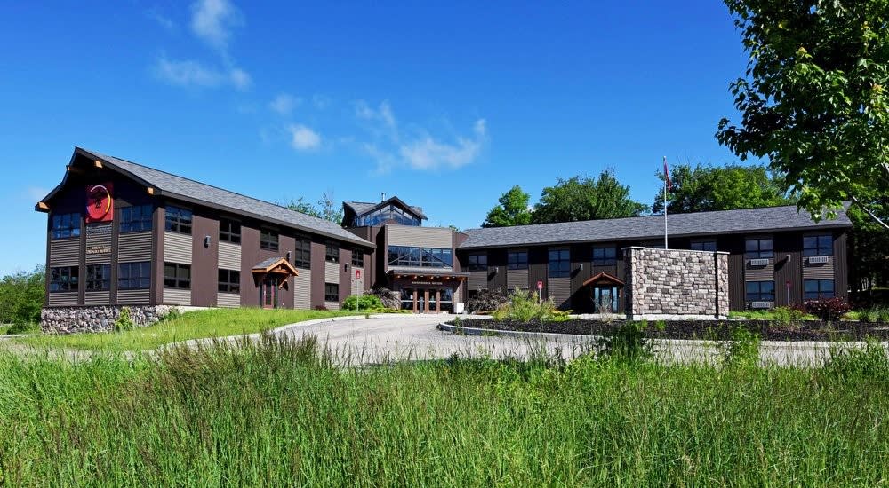
The Anishinabek Nation Head Office, Nipissing First Nation, Ontario
Unifying and Managing Land Data
To preserve cultural heritage and foster environmental stewardship, Rhonda and the AN have encountered major hurdles, all based on location, including:
- Unifying data sources for 39 FNs
- Fragmented data sources across government tiers
- Data accessibility, management, ownership and protection
Protecting and owning data becomes problematic when external GIS consultants or agencies are engaged to generate data. They typically retain control of it, undermining Indigenous community data ownership and sovereignty. Consequently, this obstacle hinders the AN's management of crucial data essential for decision-making and community development.
The AN's diverse landscape, spanning from Lake Superior to Northern Ontario, presents data management, cultural preservation and environmental care challenges with each ecological zone requiring tailored strategies. For instance, water bodies like lakes pose distinct data requirements compared to forested areas, while the dispersion of the AN First Nations across remote regions exacerbates data fragmentation and ownership complexities. Addressing these challenges requires tailored solutions, emphasizing the significance of location-specific information and GIS in navigating complexities effectively.
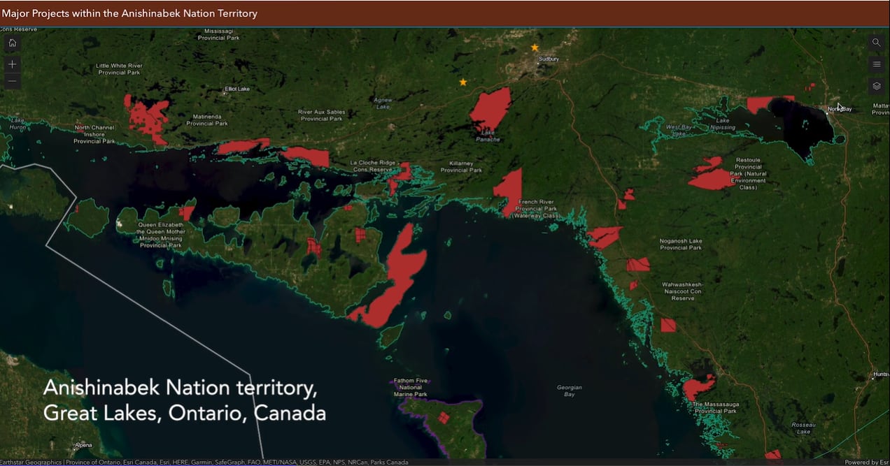
Mining claims map of the AN territory
Solution
The AN's leadership recognized the need for improved governance and leverage the Esri Canada Advantage Program (AP) to enhance public education on various initiatives. Through the AP, they gained access to tailored Esri ArcGIS products, interactive mapping, providing secure access for all 39 FNs, contribute content to the Ontario GeoHub, and platform usage training.
GIS has proven invaluable in addressing the AN’s needs through interactive tools like ArcGIS Dashboards and ArcGIS Survey123. This versatile tool aids communities in activities such as land use mapping, identifying sacred sites, managing trapping and fishing territories, evaluating mining claims, and facilitating emergency management, all contributing to informed decision-making.
“When we look at decision-making, we can see how the technicians within the community can use storyboards, web maps, instant web, field—whatever it may be—gathering, managing their own data, becoming data owners of their own data, asserting data sovereignty. They're building capacity and benefiting the community with better decision-making as a collective for the community or as a collective with many communities. That’s how I see Esri helping, with education, data management and support for our communities.”
- Rhonda Gagnon, Lands and Resources Department Manager, Anishinabek Nation
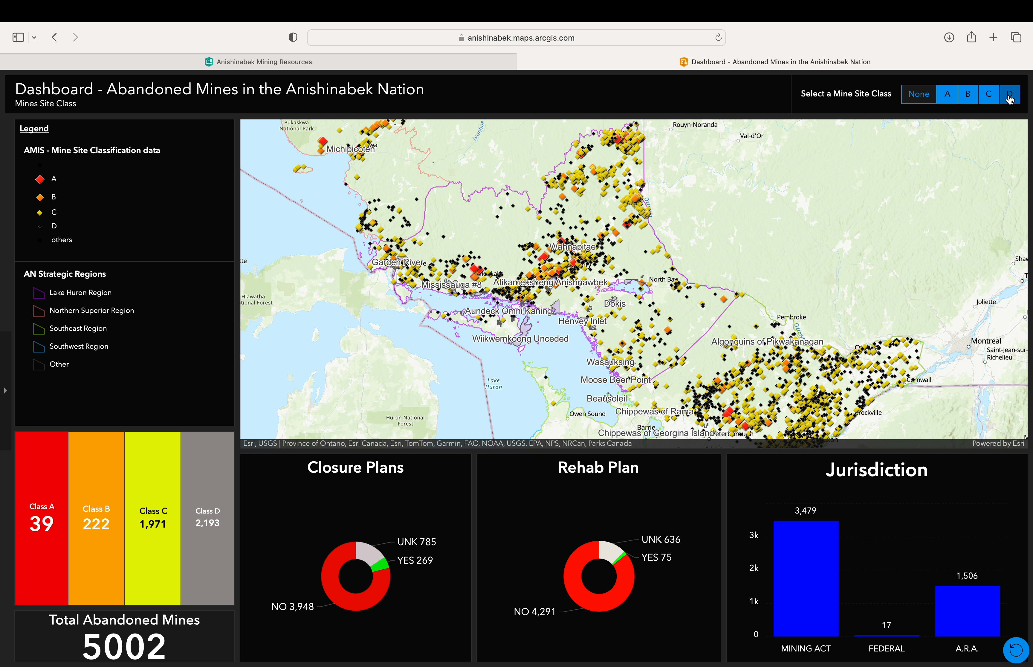
ArcGIS Dashboard of abandoned mines in the AN territory
Benefits
Data consistency, accessibility and quality control from standardized data formats
By organizing vast volumes of data into a centralized system accessible to nations, regions, and communities, Esri is facilitating collaboration among AN community members with invaluable resources for informed decision-making. This transition from non-existent to available data resources has saved countless hours and instilled greater confidence in data quality and control.
Independent decision-making from continuous training programs
Rhonda and AN policy analyst Jenny Campbell educate FNs on data collection and storytelling, employing maps to aid their understanding and usage of accurate, relevant and trustworthy information. The AN continuously provides training on Esri tools to community members, which generates transferable skills, job stability and reduces reliance on GIS consultants, allowing for clearer decision-making.
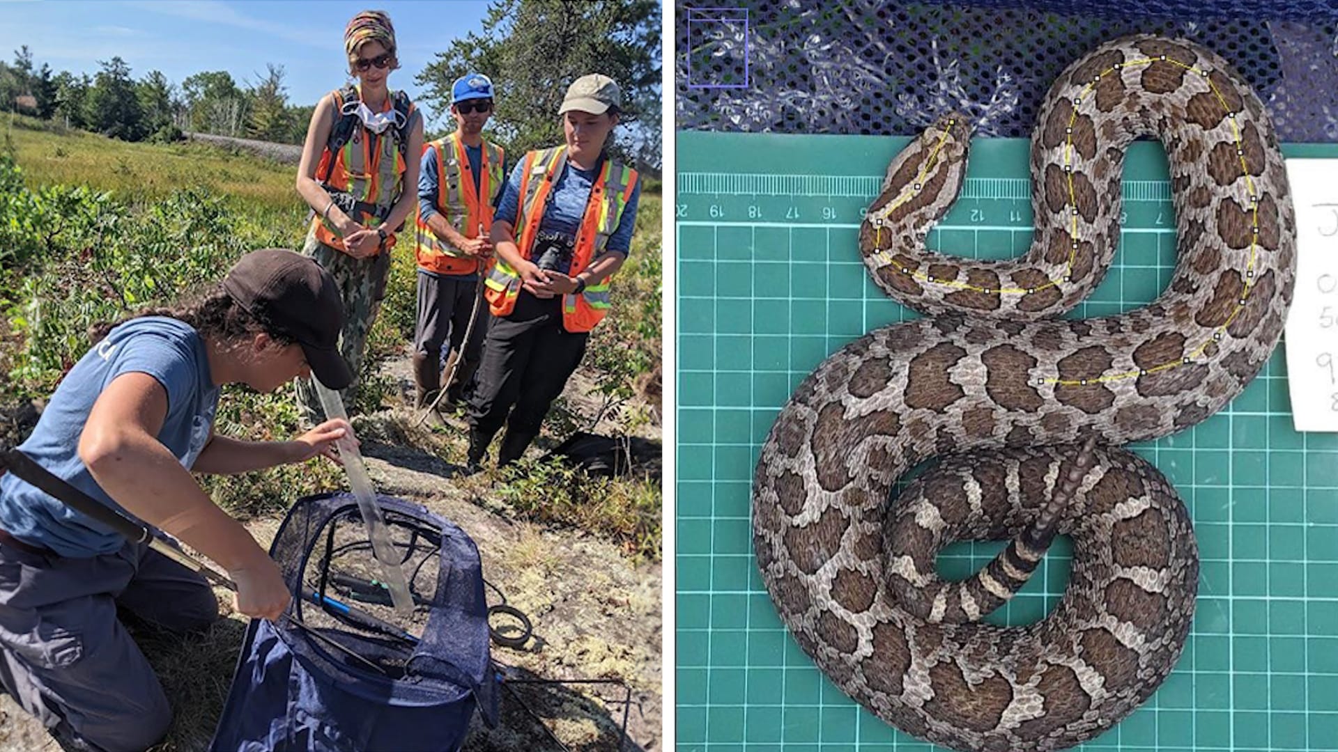
Massasauga snake monitoring at Magnetawan First Nation, teaching staff and partners safe handling techniques, tagging, measuring and weighing this small venomous snake. Left image: ‘tubing’ the snake. Right image: measuring the snake’s length from a photo on a scale grid.
Integration of ancestral wisdom for cultural preservation
An example of this is Rhonda's personal Survey123 project of naming places within the initial recognition territory. It demonstrates the role GIS can play in preserving Indigenous knowledge through meticulous spatial documentation and cultural mapping efforts.
Results
Community access to tailored GIS tools fosters active involvement in land management discussions. Interactive training and ArcGIS StoryMap stories deepen understanding, promoting inclusivity and sustainable practices while fostering a sense of connection and ownership.
- Enhanced Data Integration: By unifying data sources for 39 FNs, the AN ensures that community members have access to comprehensive and standardized data sets, enabling more informed decision-making and streamlined resource management across the region.
- Streamlined Data Collaboration: Addressing fragmented data sources across government tiers improves coordination and collaboration between Indigenous and governmental entities. This streamlining enhances data integrity, reduces duplication efforts, and fosters greater transparency in decision-making processes related to land and resource management.
- Strengthened Data Security Measures: Implementing robust data accessibility, management, ownership, and protection protocols safeguard Indigenous communities' data sovereignty and integrity. These measures ensure that sensitive information is securely gathered, stored, accessed only by authorized personnel and utilized ethically and responsibly to support community development initiatives while respecting cultural values and traditions.
“Land use and occupancy is very important to our communities. It shows that they assert jurisdiction, not ownership, but a stewardship role within their territory. It also supports if there's a decision that's going to be impacting the community from a proponent, either from a mining company, impact assessment—whatever it may be—[GIS tools] solidify evidence that the community is utilizing the land or the water.”
- Rhonda Gagnon, Lands and Resources Department Manager, Anishinabek Nation
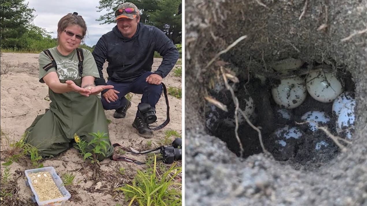
Turtle eggs at risk of being destroyed are located, nested and incubated in Nipissing First Nation. Left image: excavating a turtle nest. Right image: painted turtle nest cavity once excavated carefully from the surface.
Looking Ahead
Moving forward, Rhonda seeks to broaden GIS integration across all AN departments for better project planning, funding, and capacity-building. Recognizing the importance of preserving traditional knowledge alongside Western science, Rhonda aims to train all 39 FNs in GIS tools, nurturing community ownership and robust data management. Through unified data sources and enhanced accessibility, Rhonda and GIS solutions enable all AN First Nations to safeguard ancestral lands, protect cultural heritage, and bolster environmental stewardship for generations to come.
New to Geographic Information System (GIS) Technology?
Find out What Is GIS?
Learn how Indigenous nations strengthen resource management and environmental stewardship with GIS on our Indigenous Peoples page.