Arabelle Sauvé: Supporting French educators in Canada
Meet the latest addition to the K-12 group at Esri Canada. Arabelle Sauvé is the K-12 Bilingual Teaching and Learning Specialist from Montréal, Québec. Discover what she’s been doing to ensure French-speaking K-12 educators have access to relevant resources to integrate GIS in their teaching.
Arabelle Sauvé from Montréal, Québec is the newest K-12 member in the Education and Research group at Esri Canada. Since April, as the K-12 Bilingual Teaching and Learning Specialist, she’s been supporting French-speaking educators who want to bring GIS into their teaching.
Let’s learn more about Arabelle and discover what she’s been doing to move GIS forward in French-speaking Canada in K-12 education.
“I believe education is the key to a lot of our complex societal challenges and I feel lucky to be able to assist elementary, middle and high school teachers in their important task to introduce their students to the world.”
Arabelle completed her bachelor's and master's degrees in Geography from the Université du Québec à Montréal (UQAM) in 2016. Her master's research project was in paleoecology-paleoclimatology, also known as the reconstruction of past ecosystems and climate. In her work, she reconstructed the regional vegetation and forest assemblages using palynology (pollen found in peatlands) for the Havre-Saint-Pierre and Baie-Comeau areas, located on the North Shore of the St. Lawrence Estuary and Gulf.
Her love of the natural world inspired Arabelle to take part in building awareness on environmental issues through education while she was a student volunteer and in her past jobs. This is something that is very important to her. While working at the Kahnawà:ke Environment Protection Office, a part of the Mohawk Council of Kahnawà:ke, she was responsible for georeferencing data, designing maps and apps to build knowledge and protection of the natural environment in that area. This organization’s goal is to “fight to protect and better our environment.”
Even though Arabelle is not a teacher, she is familiar with the education circle, as she grew up around teachers. Her mom and aunt were teachers and currently, her sister teaches special education.
Arabelle's been busy connecting with educators and consultants at school boards and ministries of education to promote the use of GIS across curriculum. In five months, she’s built education contacts in Newfoundland and Labrador, New Brunswick, Ontario and Québec.
“Arabelle has been very helpful with revising the ArcGIS Online pour Écoles de l'Ontario subscription home page. She’s made big improvements to it. What a great asset she is to your team!” – Claude Brun del Re
With her knowledge of ArcGIS, she’s been creating new French ArcGIS resources, translating existing ones, answering tech support questions, and providing activity ideas for teachers who are new to GIS. Through social media, Arabelle’s been sharing inspiring projects and ideas through @SIG_a_lecole the Esri Canada K-12 French Twitter account and on the Cartes narrative – StoryMaps – pour l’éducation ArcGIS Online Group that include story maps in French on interesting themes for K-12 students.
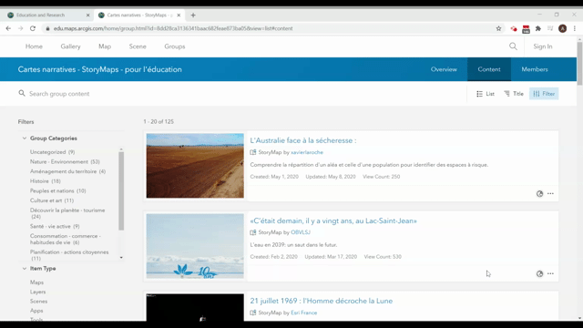
Explore the Cartes narratives – StoryMaps – pour l’éducation group to view interesting story maps in French.
In the coming months, Arabelle will be facilitating workshops for educators and education consultants who are planning to bring GIS into their teaching.
Connect with Arabelle at k12@esri.ca. Begin your GIS with French resources at k12.esri.ca/fr/.
This post was translated to French and can be viewed here.