On the Map with Maximum City
Maximum City is a longtime Partner in Education and the winner of Esri Canada’s 2025 Making a Difference Award. We’re excited to highlight their latest project, explore why their work matters, and share what’s coming later this year.
Maximum City is an urban education organization that has become synonymous with youth engagement and empowerment, consistently creating experiences where young people feel valued, influence real decisions and shape the future of their communities.
Youth engagement is essential because young people notice details that adults may overlook and they can offer practical insights that lead to better policy, planning, and design. They will also live the longest with the decisions being made today, making their perspectives critical to building cities and systems that truly work for future generations.
Engagement Tools
Maximum City is getting youth involved through their innovative YouthScore and KidScore activities that take young people outside to evaluate the child and youth friendliness of urban environments, using ArcGIS mapping tools to collect information and capture the youth voice. These engagement tools are used in Maximum City’s summer camps and school workshops.
The KidScore has been successfully implemented in civics and social studies classes, and it won the 2020 IAP2 Core Values Award for Diversity and Inclusion.
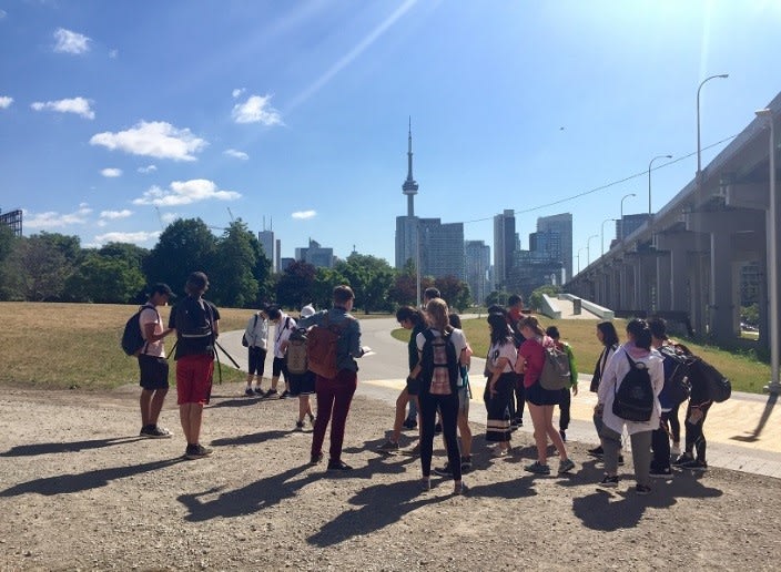 Students working on the YouthScore in Toronto, Ontario.
Gaining Youth Perspectives during the Men’s World Cup 2026
In their latest multi-year initiative, Maximum City is in collaboration with the Centre for Sport and Human Rights to help youth share their stories of the Men’s World Cup 2026 in their communities. The goal is to advance child rights, safety, and gain meaningful participation of host cities, while driving long-term improvements in how youth experience major sporting events and urban environments.
During the event, ArcGIS is used by youth to collect and visualize the youth perspective across the three main host regions: Toronto, New York/New Jersey and Guadalajara. Participants enter their data in a survey created in ArcGIS Survey123 in areas surrounding stadiums and fan zones, mapping the responses and visualizing the results in a dashboard created in ArcGIS Experience Builder.
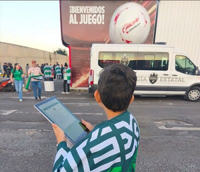 A young soccer fan participating in the survey in their city – Guadalajara, Mexico.
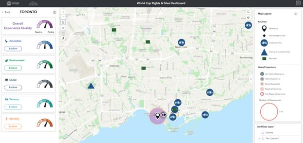 In the Toronto Dashboard, for example, users can explore youth experiences at specific sites and compare subjective perceptions with objective indicators such as air quality, public transit access, and local amenities (e.g., water fountains and public spaces).
Setting a Precedent
The surveys and dashboards give young people a platform to share their experiences of and perspectives on the World Cup, amplifying youth voices and providing decision-makers with evidence-based insights to guide planning and improve outcomes. This World Cup will be the first to include formal human rights planning at the host-city level, marking an important step toward establishing a new global standard for how major sporting events are designed and delivered.
Why ArcGIS
ArcGIS is viewed by Maximum City as a highly effective tool for child and youth engagement because it supports the development of key skills such as systems thinking, spatial awareness, civic engagement, and data literacy. Much of their work with young people focuses on building a strong sense of place and stewardship for the social and built environments where they live and go to school. The ArcGIS tools deepen this connection by enabling real-time inquiry, exploration, and understanding of these environments.
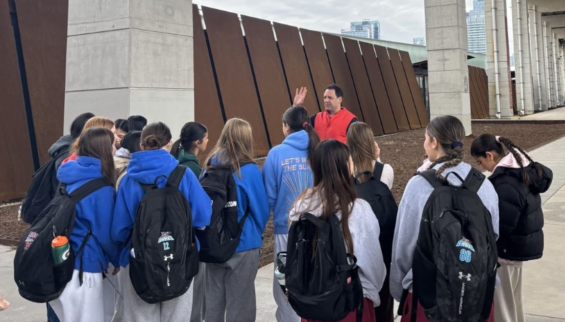 Josh Fullan, Executive Director, Maximum City facilitating a student workshop at the Bentway in Toronto, 2026.
Why Their Work Matters
Maximum City’s work with youth is driven by three interconnected values: learning, connection and participation. This is evident in their projects as youth are the focus. They are introduced to key concepts in urban planning and community design and during the process, they have an opportunity to connect with other young people and build spatial awareness while developing a sense of civic engagement and responsibility.
This commitment to meaningful youth involvement is one of the reasons Maximum City was honoured by Esri Canada in 2025 for its leadership in urban education. You can learn more by watching the video “Making a Difference: Connecting Youth to Community Through GIS.”
What’s Next?
Maximum City is preparing to launch KidScore v2, an enhanced version of the hands-on activity. This version will feature revised survey questions designed to capture more nuanced insights, along with a redesigned dashboard offering improved functionality.
New features will include advanced data filtering tools, expanded visualization options, curriculum connections, and a more user-friendly interface, enabling both students and stakeholders to explore data more effectively. These updates aim to deepen engagement, improve data quality, and further support evidence-based decision-making.
After the summer and once the World Cup event is over, there will be a unique dataset that meaningfully captures child and youth experiences of the World Cup. The youth experiences and recommendations shared with the Centre for Sport and Human Rights and Maximum City will be published with the other research partners on the project (Center for Violence Prevention Research, Loughborough University, University of Toronto, and Canterbury Christ Church University). The Centre for Sport and Human Rights aim to apply this approach and methodology to future Major Sporting Events to build the knowledge base and improve the fan and family experience.
We look forward to learning more about Maximum City’s future initiatives and to strengthening our ongoing partnership in education.
Educators can learn more about their work and connect directly with Maximum City.
Happy Mapping!