Mitchell Eastley named Esri Canada’s GIS Professional of the Year
City of Steinbach’s geographic information system (GIS) developer honoured for contributions to the geospatial profession through technical excellence, advocacy and community engagement
TORONTO—November 4, 2025—Esri Canada is pleased to announce that Mitchell Eastley, GIS developer and technician at the City of Steinbach, Manitoba, has been named the 2025 GIS Professional of the Year. This inaugural award recognizes Canadian geospatial professionals who have demonstrated outstanding leadership and excellence in applying geographic information system (GIS) technology, advocating for GIS mapping solutions and fostering community engagement to elevate the profession. The award was presented in front of more than a thousand GIS professionals at the Esri Canada User Conference in Toronto on November 4.
“Mitchell exemplifies the spirit of innovation and community that defines the GIS profession,” says Alex Miller, president, Esri Canada. “His work at the City of Steinbach demonstrates how one individual can drive significant change using GIS solutions, not only within their organization but across the broader geospatial landscape. We’re pleased to recognize Mitchell as the first GIS Professional of the Year and look forward to seeing his leadership continue to inspire others.”
Mitchell has created transformative geospatial applications for the City of Steinbach, where he serves as the sole GIS professional. His work supports multiple departments, including engineering, planning, waterworks and public works. His approach focuses on strategic planning, user engagement and clear communication as demonstrated in his mapping applications for traffic bylaws, road restrictions and municipal election results. Among his most impactful projects is the Property Information and Development Map, which provides public access to parcel, zoning and tax assessment data—enhancing transparency and service delivery.
“Not only is it gratifying to see the City evolve through GIS technology,” says Troy Warkentin, city manager, City of Steinbach. “It’s equally, if not more so, gratifying to see Mitchell grow as a person in his career and his capabilities. The City is certainly appreciative and better for it.”
Beyond his municipal role, Mitchell is an active contributor to the broader GIS community. He serves on the Community Map of Canada Advisory Council, promoting authoritative data and collaborative mapping, which has helped build a detailed, ready-to-use web basemap of Canada and improve data quality across jurisdictions. He also volunteers to judge GIS app challenges and mentor emerging GIS professionals.
“I’ve always believed that GIS is about making a difference—whether it’s helping a neighbour on the farm or supporting a colleague with a new tool,” says Mitchell. “Taking the time to listen and plan mapping applications with end users is what makes my work meaningful and impactful. Seeing users appreciate and benefit from GIS solutions is what drives me to keep innovating and sharing what I learn.”
Mitchell is excited about the future of GIS, particularly the role of artificial intelligence in predictive modelling and language translation, which he believes will make GIS more accessible and powerful for communities.
Learn more about the many uses of geospatial technology at the free GIS Day in Canada virtual event on November 18.
About Esri Canada
Founded in 1984, Esri Canada provides geographic information system (GIS) solutions that empower people in business, government, and education to make informed and timely decisions by leveraging the power of mapping and spatial analytics. These solutions enable organizations to better manage their resources, plan their future and collaborate within and beyond their organization. Esri Canada’s products and services help advance successful digital transformation. The company serves more than 14,000 organizations from 13 offices across Canada and is based in Toronto. Esri Canada has been recognized as one of Canada’s Best Managed Companies for 13 consecutive years. More information can be found at esri.ca. Follow Esri Canada on X (Twitter), Facebook, YouTube, Instagram and LinkedIn.
For media inquiries, please contact:
Esri Canada
press@esri.ca
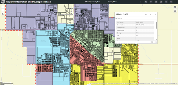
City of Steinbach’s Property Information and Development Map, created by Mitchell Eastley, helps businesses and developers find available land and enables residents to easily access property data.
Watch this video to learn more about Mitchell’s tenacity, innovation and commitment to driving community impact using GIS.