Building virtual geoscience tours for students—no code required
Discover how one nonprofit is using geospatial tools to produce context-rich, engaging virtual tours of some of Ontario’s most captivating geoscientific sites. Produced for tourists as well as elementary and secondary students who may have limited access to field trips, the APGOEF’s GeoHikes, Urban GeoWalks, GeoPaddles and GeoRoutes deliver a powerful, accessible view of Ontario’s geology.
The Association of Professional Geoscientists of Ontario Education Foundation (APGOEF) is dedicated to promoting geoscience education and awareness across Ontario. A member of the Esri Nonprofit Program, APGOEF aims to enhance the understanding of Ontario's geological heritage among students, educators and the public. The foundation focuses on creating accessible educational resources that encourage a connection with the land and foster a positive perception of geoscience.
A small nonprofit with one full-time staff member, APGOEF collaborates with university-based research volunteers who supply it with up-to-date, accurate data that it then transforms into educational resources for K-12 and university students and members of the general public. These resources include tools like GeoHikes, Urban GeoWalks, GeoPaddles and GeoRoutes, all housed at geoscienceinfo.com. These are self-guided tours of areas of geological interest in Ontario that use different modes of transportation.
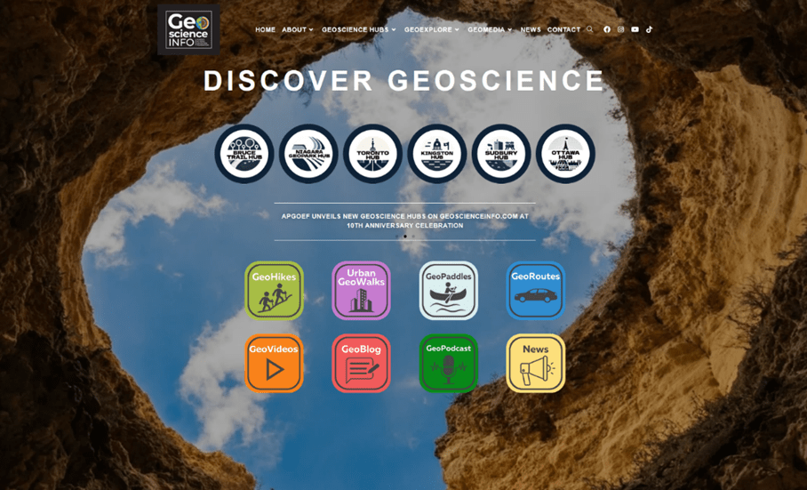
The APGOEF’s educational website, geoscienceinfo.com, is a hub for Ontario-based geoscience learning.
Engaging Ontario’s elementary and secondary students with compelling geoscience resources
Given its small size, APGOEF was facing challenges in effectively communicating Ontario's geological heritage to its diverse audience—and moreover, in creating effective workflows that would make sharing this heritage easier.
“We want to encourage educators to incorporate geoscience into their lesson plans,” says Deana Schwarz, PhD, P.Geo., of the APGOEF. “We want geoscience to be familiar to people, and to leave them with a positive impression of the field. It starts by educating students in elementary and highschool and giving them a connection with the land around them. Engaging educational resources really help make this possible.”
Previously, the APGOEF used map files embedded into webpages to communicate the step-by-step of their self-guided tours. These map files needed to be manually updated one at a time if changes needed to be made, and the webpages needed to be laboriously recreated any time a website redesign took place.
APGOEF had also once attempted to use a cloud mapping solution to recreate their self-guided tours, but using this solution failed to keep users within the GeoHike experience, often requiring users to click away from the APGOEF’s website to get the information they sought.
The foundation needed a solution that would allow them to present geological information in an interactive and engaging way, all in one place, while being easy to use, manage, share and maintain.
Better educational outreach through a no-code multimedia storytelling tool
In search of a better solution, APGOEF began exploring various digital platforms to enhance their educational outreach. They were introduced to ArcGIS StoryMaps by a student researcher at a partner institution and were immediately impressed by its capabilities. The ease of use and no-code nature of StoryMaps made it an ideal choice for their needs, given that there is no on-staff programmer at the foundation.
“We didn’t even consider alternatives once we saw what StoryMaps could do,” said Deana. “We just jumped on it.”
How to put students in touch with Ontario’s geology? Using interactive narrative maps
ArcGIS StoryMaps is a web-based digital storytelling tool that helps users build stories with interactive maps, text, images and videos. Organizations use StoryMaps to build rich digital narratives that transport readers to the places in their stories, without needing to write a single line of code.
GeoHikes and other guided tours developed in StoryMaps allow users to interact with Ontario's geological heritage virtually. Written descriptions are provided alongside interactive maps, scientific illustrations and audio. Whether onsite or in a classroom, a reader can scroll through a GeoHike or other tour to discover new dimensions of the place being shown.
And thanks to StoryMaps, the GeoHikes are fully mobile-ready.
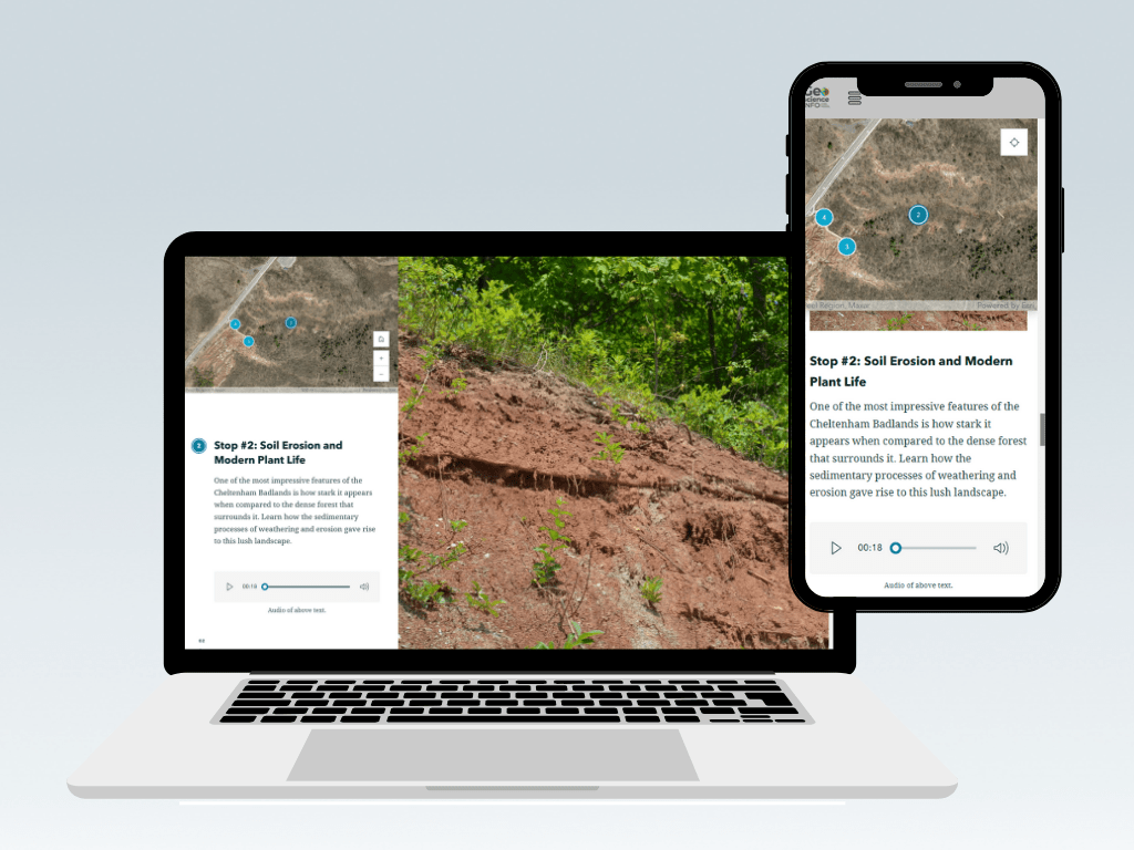
The APGOEF’s GeoHikes, Urban GeoWalks, GeoPaddles and GeoRoutes are all mobile-optimized thanks to ArcGIS StoryMaps.
The GeoHikes take advantage of unique interactive modules in StoryMaps like the sidecar module. Using sidecars, APGOEF is able to lay out maps and visual elements alongside text that is specific to them. Only once users finish scrolling through the relevant text do the visuals change, making it easy for APGOEF to tell the story they want to tell, rather than being constrained by layout.
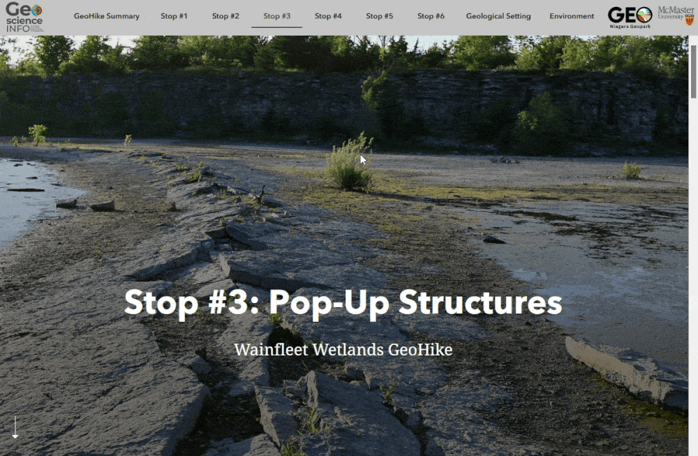
The sidecar feature lets you place scrolling text alongside media of your choice—whether it’s a photo, an interactive map, an animation or a video.
Using the StoryMaps swipe module, APGOEF can also easily show the “before and after” of any geological feature, or overlay a photograph with relevant geological labels.
The APGOEF’s virtual tours make frequent use of the swipe feature, which allows users to swipe between two versions of an image—an effective way to show a “before and after”.
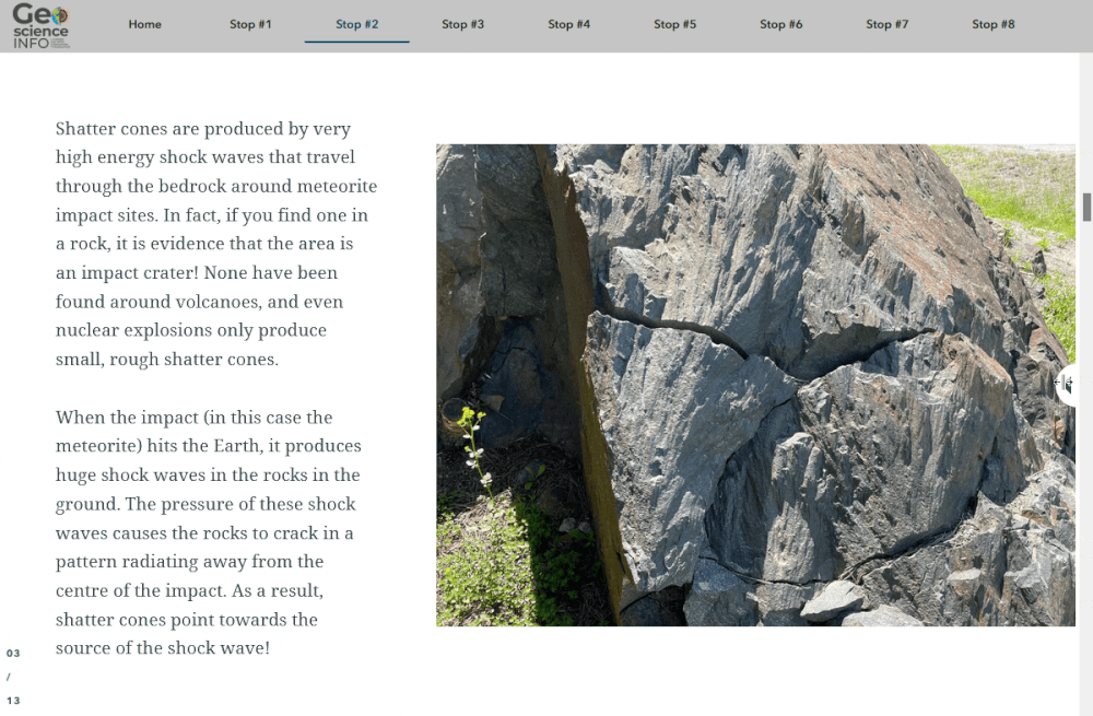
APGOEF’s GeoHikes also include high-resolution site photography, 360-degree views, 3D models built with LiDAR, animations and scientific illustrations. These make each site tangible for remote visitors, while helping onsite visitors quickly situate important features.
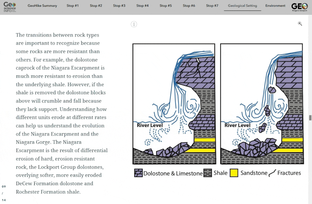
Animations, scientific illustrations and other visuals help learners grasp complex geological concepts regardless of learning style.
StoryMaps lead to better engagement from students and educators
Feedback from both educators and students has been overwhelmingly positive. GeoHike users appreciate their intuitive design, which allows them to focus on learning about geology right on their device—no additional technology learning required.
The vertical reading format of StoryMaps makes it feel like getting immersed in a good book. This ease of use has empowered non-programmers to engage with the platform, creating a more inclusive educational environment.
What’s next? New curriculum-aligned educational resources on geoscience topics
By implementing ArcGIS StoryMaps, the APGOEF has seen significant results:
- Enhanced engagement: The GeoHikes have attracted a broad audience, allowing students and teachers to explore geological features interactively, even from the classroom or home.
- Improved context for learning: The ability to set text alongside relevant images and media has enhanced users’ learning experience, enabling them to feel closer to the sites they’re visiting, whether on- or offsite.
- Future opportunities: StoryMaps has opened up additional possibilities for the APGOEF. Thanks to the time that StoryMaps has freed up, the APGOEF team is now looking to develop additional educational resources, such as a French version of the website and a comprehensive set of teacher resources that align with the Ontario curriculum.
Overall, the APGOEF's adoption of ArcGIS StoryMaps has transformed their approach to geoscience education. By leveraging technology to create interactive and accessible content, they are fostering a deeper understanding of Ontario's geological heritage among students and the public.
“A lot of feedback we hear is that it’s really easy to use. They don’t have to learn how to use it; they just scroll through. A visitor to a site doesn’t have to think about anything other than the hike, and that’s essential because it lets us do what we want with the GeoHikes without thinking about the technology.” —Deana Schwarz, PhD, P.Geo, APGOEF
Discover more about ArcGIS StoryMaps, or explore the possibilities of GIS for K-12 education—including free software access—at k12.esri.ca. Or, learn more about the Esri Nonprofit Program, which enables nonprofit organizations to leverage geospatial technology in their work.