Coming full circle: The evolution of the Canadian web basemap & community
Two hundred communities (and counting) weave a homogenous basemap of Canada. You, too, can benefit by enriching the Community Map of Canada.
It is now my third week as an advocate for the Community Map of Canada Program, an initiative established to unite the country’s communities to weave together a homogenous basemap of Canada.
Eleven years ago, I sat in the office of Esri Canada’s President, Alex Miller, alongside other members of the leadership team including Gordon Plunkett, Chris North, George Kouroupis, and Matt English, to assemble the framework of an event, which would later be known as “The Kingsbridge”. This summit called key influencers, from various federal and provincial agencies, to agree on the need for a “Web Basemap of Canada” and what this map would look like.
Esri Canada held the inaugural Canadian Web Basemap Summit in 2009, which saw the beginnings of the Community Map of Canada program
As an event coordinator back then, little did I know that my career would bring me back full circle to be part of this vision-turned-reality project. There are now more than two hundred communities contributing their data to this highly detailed, collaborative, up-to-date and most importantly, authoritative basemap, better known as the Community Map of Canada.
Over the years the program has seen many examples where cities and towns have started their mapping journey at the ground level, and with the support of the Community Map program, have built robust and compelling basemaps that have served their community’s needs.
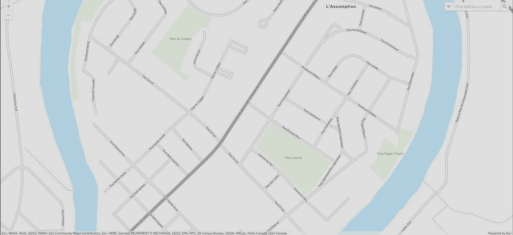
Take for example the below before and after snapshot from Community Map participant: L'Assomption, Quebec. The “after” map, which includes building footprints, parks and addresses, offers a complete view of the local landscape.
I’m proud to have played a part in this program’s inception and excited to see how we continue to evolve while providing accurate data layers to municipal and regional stakeholder across the country – and at no cost to our users.
Wondering what benefits you can gain by joining this free program? Allow me to walk you through three:
- Efficiency: No need to recreate the basemap wheel. You feed your data into the machine and consume it however many times after that.
- Consistency: Your applications have a cohesive look and feel. Context is maintained throughout your deliverables.
- Leadership: Your expertise isn’t just in creating maps, it’s in delivering the intelligence based on location. Let us do the heavy lifting for you while you shine.
Ultimately each of these benefits improves your customer service levels. Okay, so I lied…I walked you through four benefits, not three.
Have I managed to spark your curiosity to learn more? Let's talk! Ping me at akotb@esri.ca to discover how the Community Map of Canada program can work for your needs.