What's new and improved in Esri Canada K-12 resources and support
Discover the latest updates to our K-12 resources and support! Explore the beta version of the revamped Resource Finder, along with our new ArcGIS lessons, course collections, and activities!
Year-round, our group is dedicated to supporting K-12 educators in their ArcGIS journey. The Esri Canada K-12 Resource Finder is a key support tool that we provide, designed to help educators discover valuable resources for integrating mapping, analysis and spatial thinking into their teaching. Whether they’re just starting out or are experienced ArcGIS users, this site offers a wide range of teaching and learning materials to support their needs.
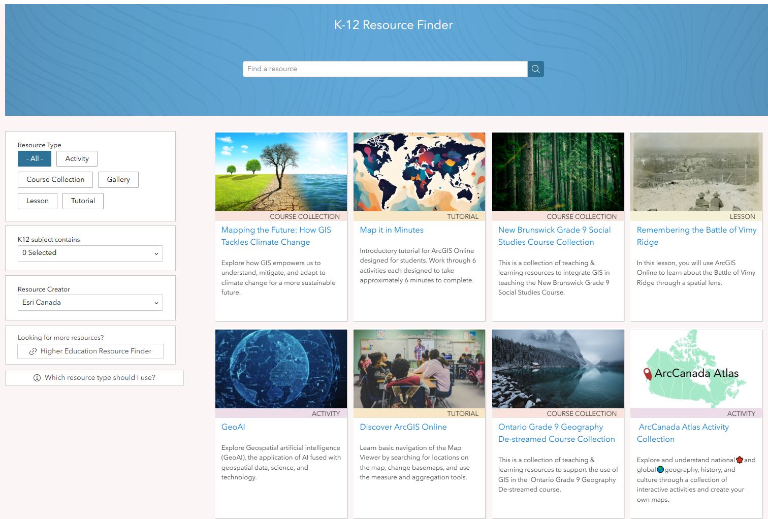
We recently created a refreshed version of the K-12 Resource Finder to provide improved user experience, making it easier for educators to find resources that fit their specific requirements. The updated site, available in beta, includes resources created by Partners in Education, a link to the Higher Education resources, and if educators are unsure which resources to use, a helpful link guides them in selecting the right ones.

The beta version of the new K-12 Resource Finder has improved user experience, making it easier for educators to find resources that fit their specific requirements.
Let’s see how you can access the Resource Finder Beta:
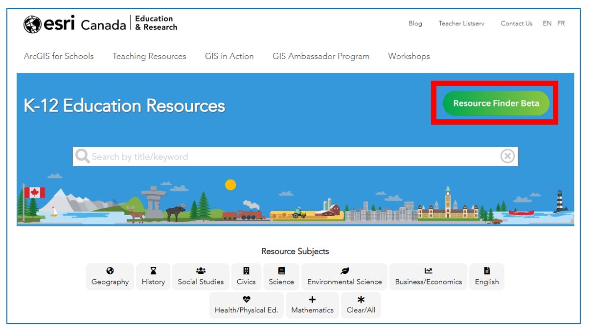
Step 1 - Go to k12.esri.ca > Find Resources OR k12.esri.ca/resourcefinder
Step 2 - Click on Resource Finder Beta.
 'This image shows you where you can access the Resource Finder Beta from the Esri Canada K-12 Resource Finder website.
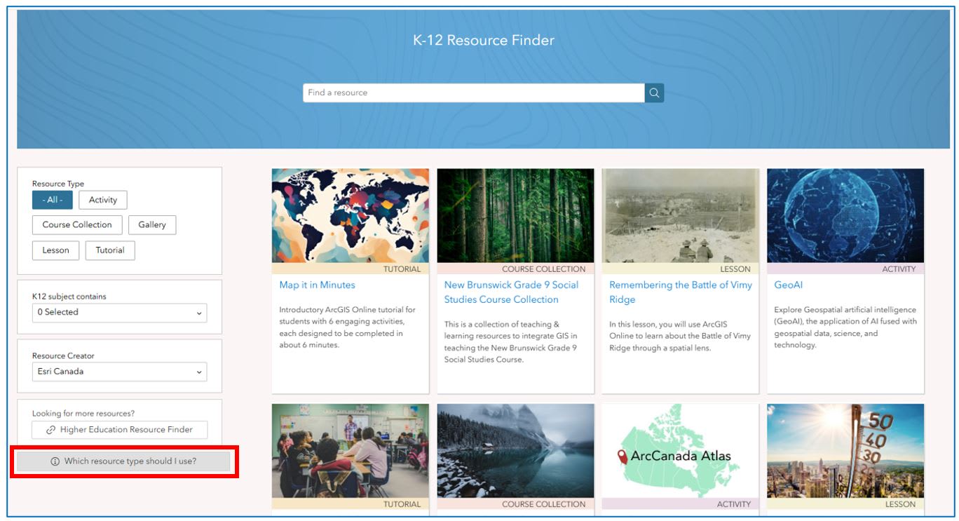
Unsure which resources to use?

This image shows you where to access a helpful guide about selecting the right resource from the new Resource Finder.
New and Updated ArcGIS Resources
Resources are continuously being updated or newly created to provide educators with additional content they can use throughout the school year. Check out the latest resources we have created that include Lessons, Course Collections, Tutorials, and Activities.
Tutorial
Map it in Minutes (Updated from ArcGIS Online Six by Six Activity)
In this tutorial you will learn the basics of ArcGIS Online by completing six activities, each designed to take approximately six minutes to complete.
Course Collections
Climate Change Series - Mapping the Future: How GIS Tackles Climate Change
Explore how GIS empowers us to understand, mitigate, and adapt to climate change for a more sustainable future.
New Brunswick Grade 9 Social Studies Course
This is a collection of teaching & learning resources to support educators to integrate geographic information systems (GIS) in teaching the New Brunswick Social Studies Grade 9 course.
Ontario Grade 9 Destreamed Course
This is a collection of teaching & learning resources to support educators to integrate geographic information systems (GIS) in teaching the Ontario Grade 9 Geography Destreamed course.
Lessons
Remembering the Battle of Vimy Ridge (Updated)
In this ArcGIS Lesson, students will be Historians. They will use ArcGIS Online to explore an important event in history through a spatial lens. They will explore the movements of the Canadian troops during the Battle of Vimy Ridge (April 9-12, 1917), analyse and mark the location of significant features in the battle, and examine the crucial role geography played in this historic conflict.
Climate Change Series - Urban Trees: Battling Heat, Climate Change, and Crime
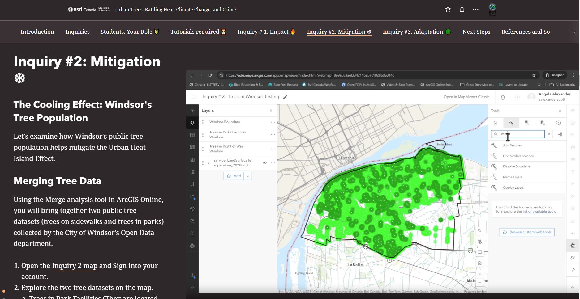
In this lesson, students will use ArcGIS Online to analyze and identify optimal locations for planting public trees in Windsor, Ontario to support the goal of a healthier and more sustainable city for its residents. Your assessment will consider factors such as land surface temperature, existing tree coverage, population density, heat vulnerability index, and incident reporting.

Students use analysis tools in the Urban Trees: Battling Heat, Climate Change, and Crime lesson to analyze and identify optimal locations for planting public trees in Windsor, Ontario to support the goal of a healthier and more sustainable city for its residents.
Climate Change Series - Invasive Species: Emerald Ash Borer
In this lesson, you will use ArcGIS Online to explore, assess and analyse tree data related to the EAB issue in Oakville.
Activities
ArcCanada Atlas Activity Collection
Explore and understand national 🍁 and global 🌎 geography, history, and culture through interactive activities and create maps.
GeoMinds
This activity for students allows them to discover how GIS is a pivotal skill set in the digital age that supports decision-making across various industries, including environmental science, urban planning, public health, and beyond. They can chart a course to the future, where GIS knowledge is not just an asset but a gateway to innovation and career excellence.
GeoAI
Explore Geospatial artificial intelligence (GeoAI), the application of AI fused with geospatial data, science, and technology.
Inspired to get started with ArcGIS Online?
K-12 educators can sign up today at k12.esri.ca. Begin your journey with the following resources:
Let’s get started with ArcGIS Online
Self-guided learning for K-12 educators