GIS for Kids: What’s the Right Age to Start?
GIS Ambassadors brought learning to life by leading fun, engaging activities with preschoolers in Québec.
We’re frequently asked, “is my child too young to participate in an activity using geographic information systems (GIS)?” The answer: if they can hold a simple conversation, they’re ready! Activities can be tailored to the child’s level, what works for kindergarten won’t be the same for second grade or high school. For younger learners, adults can guide and supervise more closely, while older students gradually take the lead. Over time, they will build confidence and skills to complete an entire GIS project on their own. Here you will recognize the scientific method:
- Establish questions and problem statements: the project theme
- Prepare to gather information (data) by preparing a list of questions or observations that the student will make
- Collect information by filling out a form or mapping it directly onto a layer
- Analyze the collected information (data) in the form of maps, dashboards, diagrams, etc.
- Connect the collected information with reliable sources of knowledge using a story
- Communicate your understanding and conclusions
Needless to say, when working with younger learners, these steps are simplified and take place more as a conversation.
In the spring of 2025, GIS ambassadors Albert Chifoi and Frédéric Blouin-Michaud each conducted activities in their respective children's preschool groups: in a kindergarten class in Laval and in a daycare centre in Montréal.
Albert, would you introduce yourself?
My name is Albert Chifoi and I’ve been a sales representative with Esri Canada since 2023. I’ve been involved in geographic studies for a little over 10 years. My passion is understanding the relationship between people and their environment. How do people shape their environments and, in turn, how do those environments influence the lives and histories of the people within them?
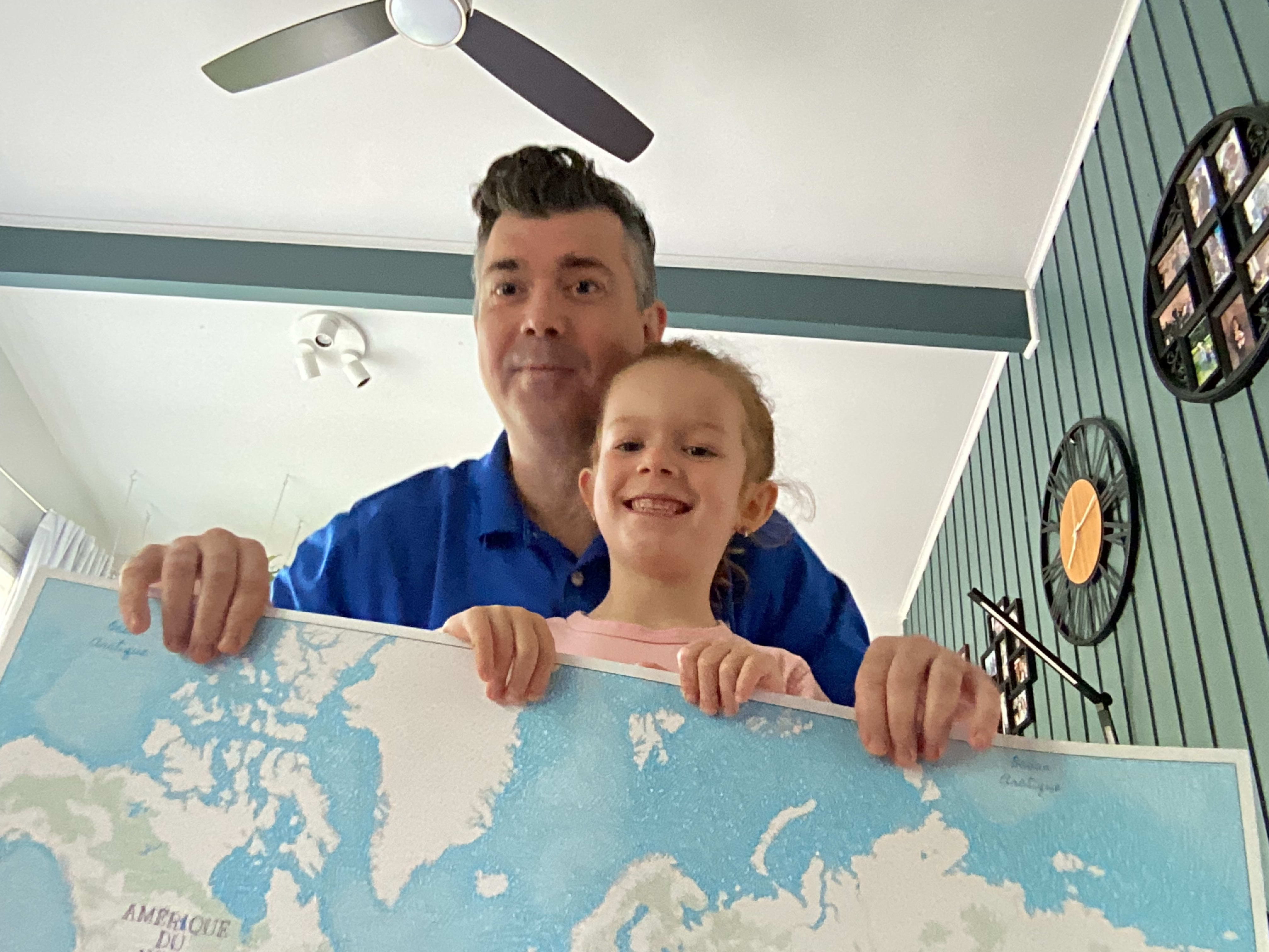 Albert Chifoi and his daughter holding the printed map that was used during the classroom activity.
Talk to us about the activity you hosted.
The activity was carried out at a public elementary school in Laval, Québec. The kindergarten students spent one hour on the activity. The project stemmed from an initiative by my daughter's teacher. At the beginning of the school year, she asked parents to get involved. With the teacher's support, I suggested that the students bring in an object from another country that they had at home and that belonged to a family member. In class, the students were asked to give a short description of the object and its origin. While chatting with the students, I collected the information in a survey form, built using ArcGIS Survey123, that automatically displayed it on a virtual map created using ArcGIS Online. The students also marked the location of their object with a sticker on a printed map.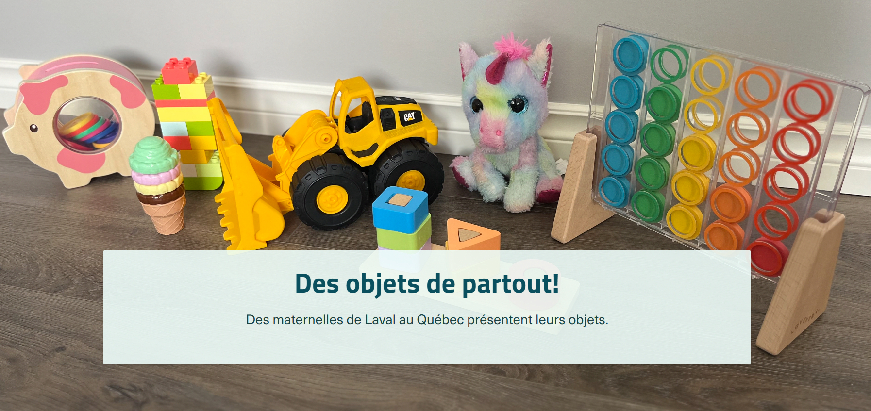
Objects from all over! Preschoolers in Laval, Québec, display their objects (in French)
How did the students and teacher feel about the activity?
The children enjoyed the activity and it sparked their curiosity. The teacher's impression was positive.
What other projects would you like to pursue in the future as a GIS ambassador?
I’d like to continue finding ways to engage young people in exploring their environment using the tools offered by Esri. Eventually, it might be interesting to organize a fun geocaching activity.
Frédéric, would you introduce yourself?
My name is Frédéric Blouin-Michaud. I’ve been working with Esri Canada for about 9 years. I’m the Program Manager of GIS Professional Community Development.

Frédéric Blouin-Michaud
Talk to us about the activity you hosted.
At my son's daycare center in Montréal, each parent introduced themselves and talked about what they do for a living. I led an activity called “Our Family Origins” (in French) with the 4–5 year olds. It lasted about 15 minutes in total. The children were asked to talk about where their parents or a close family member came from. I then filled out a survey form, built using ArcGIS Survey123, and the location was added to the ArcGIS Online map on the big screen. This gave many of the children their first experience of using a map.

Our Family Origins” map (in French)
How did the children react during the activity?
The children referred to other tools they know that use mapping support, such as road navigation tools. Some also mentioned that it reminded them of a treasure map!
What other projects would you like to pursue in the future as a GIS Ambassador?
This is something I’d like to continue doing in my son's class (once he starts school) and in my daughter's class, gradually increasing the activity's level of complexity.
We thank Albert and Frédéric for speaking to us about the activities with pre-school children. They offered some great examples of how you can use GIS with all the little ones.
Your toolboxWe’re always available to answer your questions, and to guide and support you with your projects. Write to us at k12@esri.ca.
If you’d like to get started on your GIS adventure, visit our website to obtain free access for you and your students: k12.esri.ca.
For more activity ideas and a wide range of resources, visit our K12 Resource Finder.
This post was written in French by Arabelle Sauvé and can be viewed here.