SMART mobility project signals enhanced intelligent transportation systems
Today’s intelligent transportation systems (ITS) have made significant progress in using technology, such as Internet of Things (IoT), artificial intelligence (AI) and vehicle-to-everything (V2X) communication, to ease traffic congestion, reduce emissions and increase safety. While ITS has become more sophisticated, there’s been a lack of integration between different systems to drive insights from numerous real-time data feeds using a centralized platform. This has changed with the success of the Spatial Modelling Analytics and Real-time Tracking (SMART) project.
Led by Esri Canada, the SMART mobility project was an international research collaboration with six other consortium members from Canada (Geotab ITS, International Road Dynamics) and the Netherlands (ViNotion, Royal HaskoningDHV, Cyclomedia and Eindhoven University of Technology).
I had the privilege of leading the project, which aimed to build a solution to enable real-time traffic awareness, adaptive traffic management and efficient traffic control in cities. Having lived my whole life in Toronto, a large city with worsening traffic congestion scores according to the latest TomTom Traffic Index, I was very interested in moving the dial towards solutions for congestion.
I am pleased that the project won the ITEA Award of Excellence for Innovation, Business Impact and Standardization.
Using a centralized geospatial platform in the ITS realm
Imagine having an integrated real-time picture of your city’s transportation system, with the ability to collect data, pair it with additional related and causal information, analyze traffic and transportation scenarios, and make decisions to improve traffic flow, road safety and plan transportation expenditures all on a centralized platform. How will that improve decision making?
Through the SMART mobility project, we created the Transportation - GeoXchange® (TGX), which uses geographic information system (GIS) technology. TGX ingests and integrates disparate data sources—from real-time traffic metrics and multimodal observations to authoritative infrastructure data and historical traffic information - for visualization, analysis and sharing to support better traffic decisions.
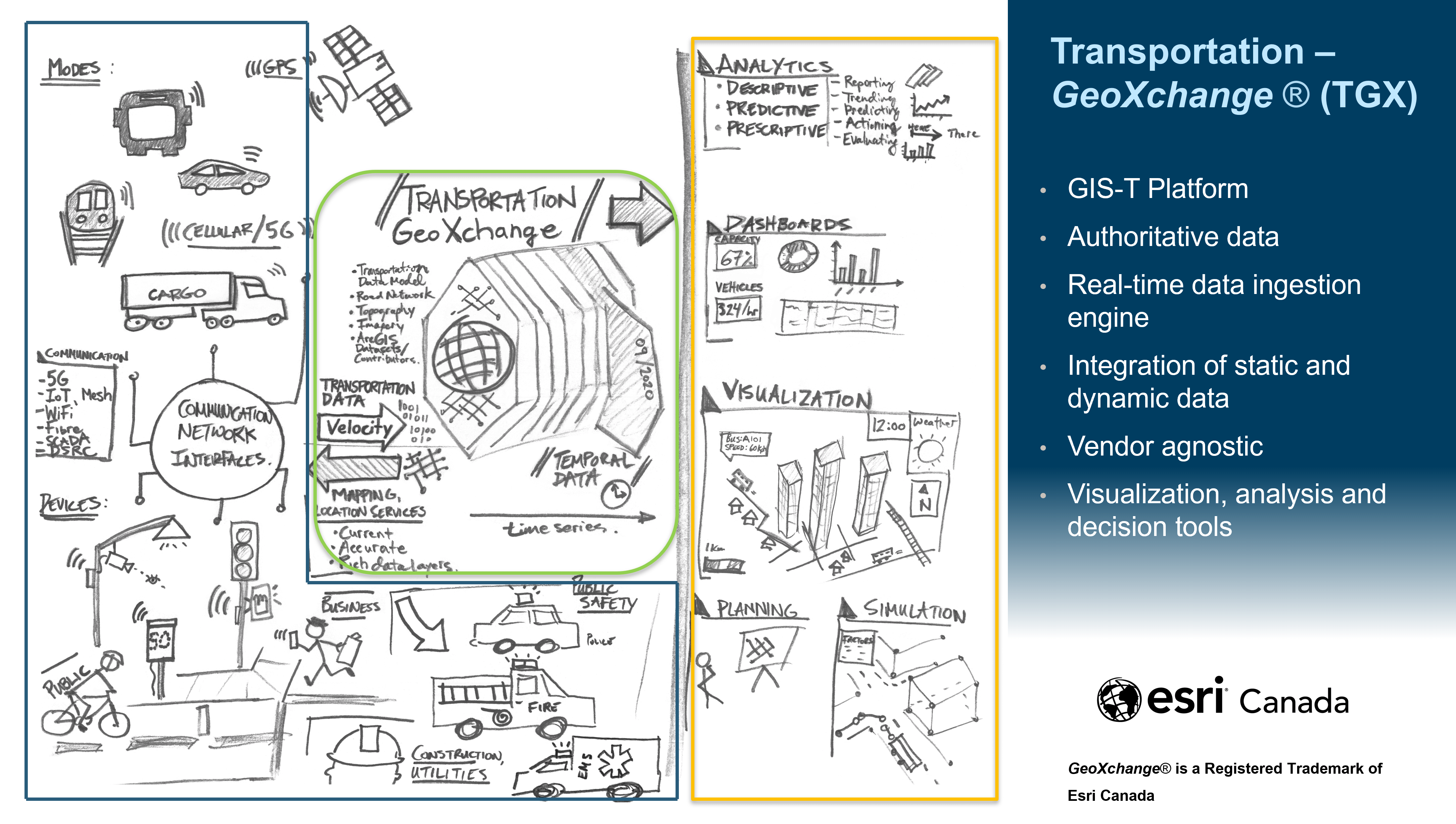
A visual overview of how the Transportation GeoXchange works; from data capture and real-time processing with ArcGIS Velocity to user outputs like analytics, dashboards and planning tools.
Since everything happens somewhere, understanding the behaviour of traffic participants within a geospatial context is vital for ITS. By co-locating inter-related data and providing tools for analysis and visualization, GIS helps city planners, traffic managers and other decision-makers understand the cause and effects of traffic congestion. It also supports decisions to improve traffic flow, reduce emissions and improve road safety.
My colleague David Stajan, Esri Canada’s technical lead for the SMART mobility project, describes the importance of integrating static and dynamic multi-modal traffic data observations in a common geospatial platform in this IET Journal article he co-authored with international partners: “Geo-Spatial Traffic Behaviour Analysis and Anomaly Detection for ITS Applications”.
The article presents a geospatial solution for analyzing traffic and detecting anomalies, which supports the complete data processing workflow including sensor data acquisition, analysis and digital twin reconstruction. The complete system has been deployed and validated on the roads of the City of Helmond in the Netherlands.
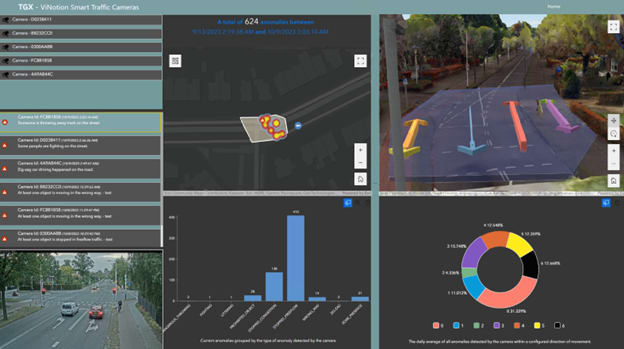
The Transportation GeoXchange is a significant improvement from traditional ITS by ingesting and aggregating real-time data, computed on the edge. It provides immediate situational awareness while at the same time builds decision data banks to provide summarized information, such as the occurrence of incidents at an intersection, shown here with various powerful visualizations.
Conclusion
For the first time, we integrated real-time traffic data computed on the edge, geolocated it onto accurate and authoritative roadway basemaps. We then combined this data with historical information on a centralized geospatial platform, ArcGIS, facilitating data-driven decision-making through spatial analysis. In putting this ability into the hands of planners, city managers, data partners, operations managers or whoever requires it, imagine how much more livable our cities could be.
Learn more about GIS in ITS https://www.esri.ca/its
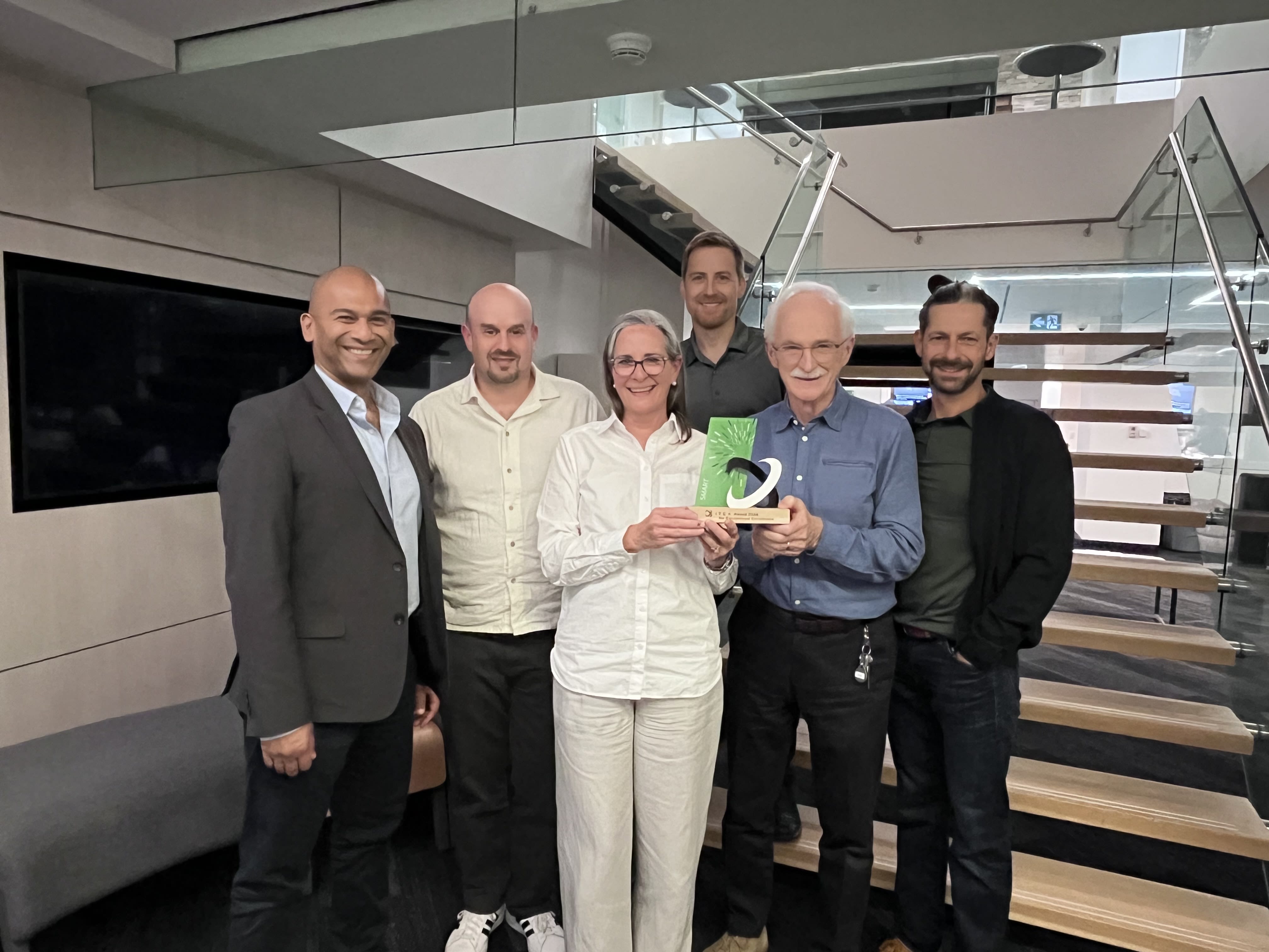
The SMART mobility project team at Esri Canada.
First row from left: Arif K. Rafiq, Industry Manager, Transportation; David Stajan, Senior Technical Lead, Solutions Design; Jennifer Overbury, Program Director, Emerging Technologies; Alex Miller, President; Darrin Williams, Executive Director, Connected Communities & Emerging Technologies
Second row: Jeff Kirchner, Senior Business Analyst