John Houweling honoured with Roger F. Tomlinson Lifetime Achievement Award
Geographic information system (GIS) advocate recognized for four decades of bold leadership empowering Canadians through GIS, shared data and analytics
Key points
- John Houweling has received Esri Canada’s Roger F. Tomlinson Lifetime Achievement Award in recognition of more than four decades of leadership advancing GIS, data sharing and analytics in Canada.
- His career helped shape major GIS and open-data initiatives, including early growth at Esri Canada, Land Information Ontario, the YorkInfo Partnership and York Region’s All Pipes program.
- Mr. Houweling is recognized as a mentor and strategic leader who has championed the use of GIS to solve real-world business, government and community challenges, while encouraging professionals to bring GIS into executive decision-making.
TORONTO—October 26, 2026—Esri Canada today announced that John Houweling has received the Roger F. Tomlinson Lifetime Achievement Award for more than 40 years of leadership in helping organizations across Canada use geographic information systems (GIS), shared data and emerging technologies to make better decisions. The award was presented at the 2026 Esri Canada User Conference in Toronto attended by more than a thousand GIS professionals.
“John has been a visionary leader and an influential voice in the Canadian GIS community,” said Alex Miller, president, Esri Canada. “From helping launch Esri Canada in its early days to driving transformative data-sharing initiatives across Ontario, John's career has been defined by innovation, collaboration and an unwavering commitment to helping others succeed. His unique ability to help people see what’s possible with technology and his leadership has empowered professionals across Canada to connect GIS with business outcomes.”
Enabling people to put GIS and data to work
A graduate of the Centre of Geographic Sciences (COGS), Mr. Houweling was among the first employees who helped launch Esri Canada, where he played a key role in growing GIS adoption across the country. Over the course of his career, he held leadership positions with Esri Canada, the Ontario Ministry of Natural Resources and York Region, where he championed innovative approaches to data governance, collaboration and analytics.
Mr. Houweling has been known for his bold, people-first approach, creating the conditions for colleagues, staff and partners to collaborate, innovate and use technology to solve meaningful problems. Guided by a simple mantra: “make a difference,” he focused on empowering others to succeed.
Strengthening collaboration through shared data
At York Region, Mr. Houweling helped advance how data was shared and used across the organization and its partners. He strengthened the YorkInfo Partnership, a collaboration of 14 organizations including municipalities, school boards and conservation authorities, by championing the York Data Co-op, a shared data platform that allowed partners to access and contribute common data resources.
To support this, he led work on shared data standards, including the All Pipes initiative, which unified regional and municipal infrastructure data. By establishing common definitions and formats, staff across all organizations could contribute consistent information to the Data Co-op and “put data to work” to improve programs and services. This collaborative approach reduced duplication, improved coordination and contributed to York Region receiving the 2020 Esri President’s Award, the first time a Canadian organization earned this honour.
Building capability through the York Region Digital Academy and AI learning
Believing that technology only matters when people feel confident using it, Mr. Houweling established the York Region Digital Academy, a stand-alone program that helped staff build digital literacy, GIS skills and a deeper understanding of how data supports better decisions.
He also led York Region’s early work in artificial intelligence, introducing AI learning programs and courses to help staff understand the technology, explore practical applications and build readiness for responsible AI adoption. This people-centered approach ensured staff had the confidence and capability to use emerging tools to improve services.
“John showed us what was possible when we connect people with information to make better decisions. That's a significant legacy that John has left us through his impact over many years at York Region,” said Erin Mahoney, chief administrative officer, York Region.
Championing open data before it was mainstream
Earlier in his career, Mr. Houweling played a key role in the development of Land Information Ontario, advocating for greater access to government data long before open data became common practice. His work helped lay the foundation for modern data-sharing principles across the province and strengthened how organizations use data to support evidence-based decision-making.
A mentor who pushed GIS into the boardroom
Known for his mentorship and direct, encouraging leadership style, Mr. Houweling has spent decades helping GIS professionals grow into strategic thinkers. He urged them to understand organizational priorities, communicate value clearly and bring GIS into executive conversations.
“My advice to GIS professionals is simple: be bold. Focus on solving business problems, get out of the back room and into the boardroom, and show leaders how GIS can help them achieve their goals. And yes, make a difference!”
Explore how GIS strengthens problem solving at esri.ca/gis
About the Roger F. Tomlinson Lifetime Achievement Award
The Roger F. Tomlinson Lifetime Achievement Award was instituted in 2014 and is awarded to an individual for outstanding contributions to the GIS community over the course of their career. The award is named after GIS pioneer Dr. Roger F. Tomlinson O.C. (1939 – 2014), who conceived and developed the first geographic information system (GIS) for the Canadian federal government in the 1960s. He initiated, planned and directed the development of the Canada Geographic Information System to create the Canada Land Inventory, a geographic database still used today by municipalities for land planning. His innovation has enabled the development of modern mapping technology and techniques and established a multibillion-dollar industry employing thousands of people worldwide.
About Esri Canada
Founded in 1984, Esri Canada provides geographic information system (GIS) solutions that empower people in business, government, and education to make informed and timely decisions by leveraging the power of mapping and spatial analytics. These solutions enable organizations to better manage their resources, plan their future and collaborate within and beyond their organization. Esri Canada’s products and services help advance successful digital transformation. The company serves more than 14,000 organizations from 14 offices across Canada and is based in Toronto. Esri Canada has been recognized as one of Canada’s Best Managed Companies for 14 consecutive years. More information can be found at esri.ca. Follow Esri Canada on X (Twitter), Facebook, YouTube, Instagram and LinkedIn.
For media inquiries, please contact:
Esri Canada
press@esri.ca
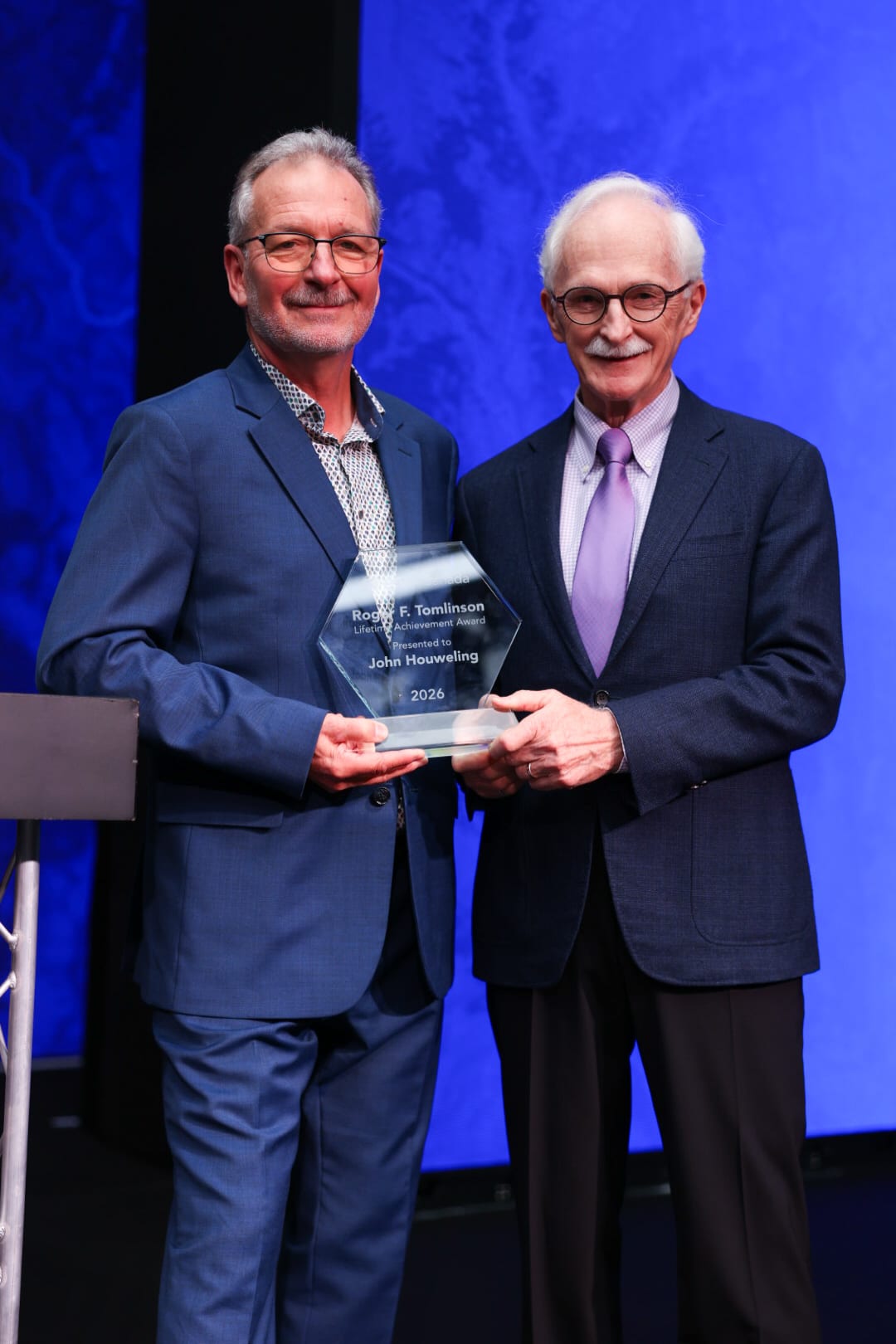
John Houweling, recipient of the Roger F. Tomlinson Lifetime Achievement Award, with Esri Canada President Alex Miller
Watch this video on the impact of John Houweling’s work