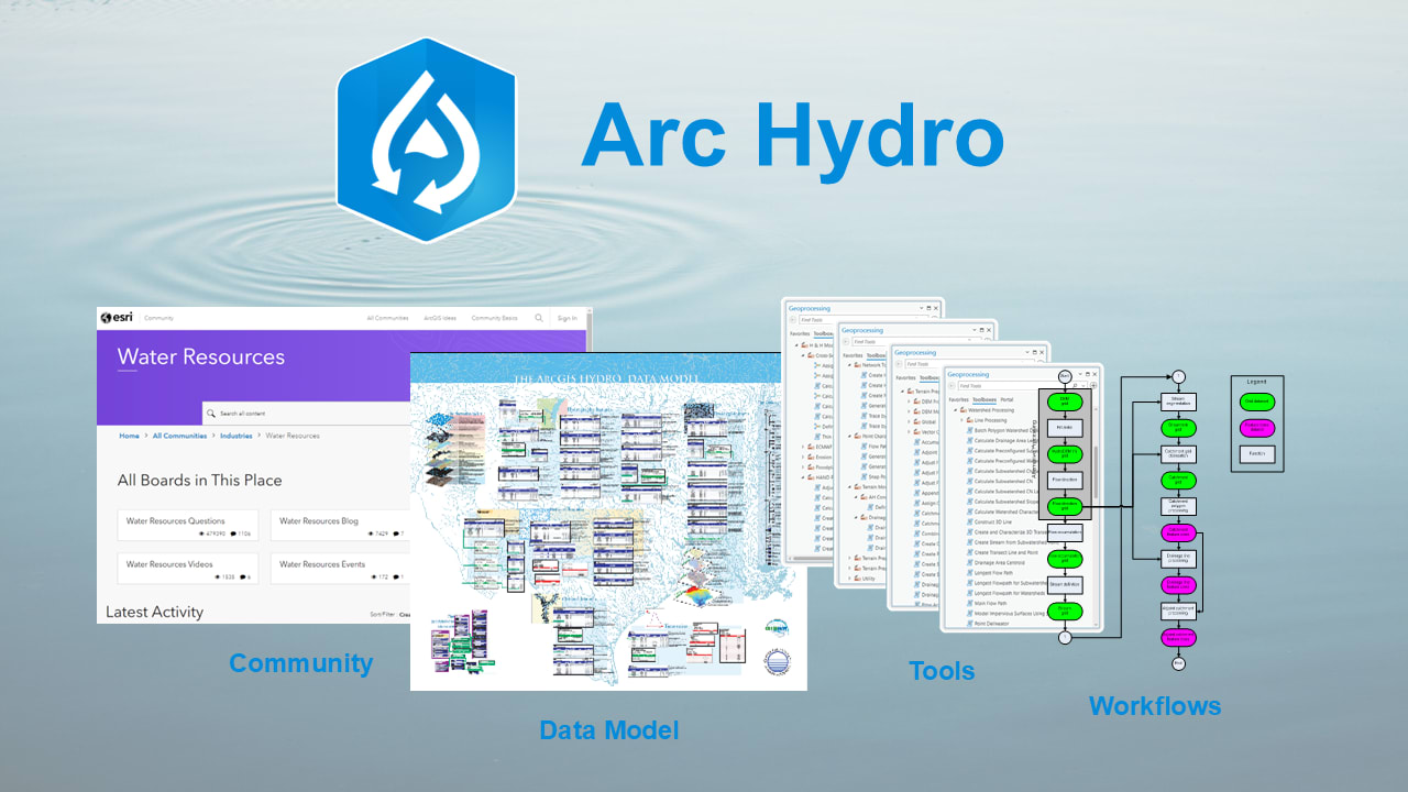
Loving our water resources with Arc Hydro
“Thousands have lived without love, not one without water.” Take care of one of our most precious resources—water—with the help of the community, data model, tools and workflows provided by Arc Hydro.
GIS for water
Information about water is fundamental to national and local economic well-being, protection of life and property, and the sustainability of our world. As W.H. Auden put it in his poem "First Things First", “[t]housands have lived without love, not one without water.” Water is so important that we even celebrate World Water Day.
The arts and sciences of cartography have come a long way to honour and protect our water resources. Thanks to the blending together of GIS workflows with hydrologic and hydraulic (H&H) modelling, we have standardized methods for mapping and spatially analyzing where a raindrop falls on the land, returns to the ocean and continuously flows throughout the water cycle.
ArcGIS is a modern spatial platform designed to help you monitor and evaluate conditions, conduct research and disseminate information. It provides scientific information to water resource managers, planners and stakeholders, facilitating community engagement, collaboration and sharing through user-friendly maps and apps.
Arc Hydro expands on the capabilities of ArcGIS by helping you build a foundational dataset suitable for water resource analysis and integration with external H&H models. It standardizes water data structures, enabling consistent and efficient use of the data to address a broad spectrum of water resource challenges at various scales, whether regional, national or international.
End-to-end watershed management support
Imagine you are suddenly tasked with mapping the surface water drainage for a geographic area and the only data you have is a high-quality digital elevation model (DEM) raster. Where do you start?
Download Arc Hydro and install the free tools on top of your version of ArcGIS Pro, licensed with the Spatial Analyst extension.
You will love the proven workflows automated in tools that conform to a standardized data model framework. Arc Hydro has been created, maintained and used by an extensive community of specialists since 1999.
Add your DEM to a map in ArcGIS Pro and run Arc Hydro tools to (1) hydrologically condition your DEM, (2) apply the appropriate terrain preprocessing, e.g. for dendritic drainage systems, and (3) derive drainage areas. This involves filling sinks, calculating flow direction, calculating flow accumulation, defining streams based on a logical threshold value and delineating drainage areas.
Once you have a filled DEM, you can easily accomplish the rest by inputting it into a workflow-based tool like the Basic Dendritic Terrain Processing tool and accepting the defaults. Arc Hydro relies on consistent naming conventions to make this all rather straightforward.
The resulting features (from a single raster!) underpin the Arc Hydro data model stored in a file geodatabase. Run a few more Arc Hydro tools and you can navigate the drainage network because the data all have the required attributes and relationships. Many external H&H models will favourably accept the derived information that Arc Hydro enables you to export in the explicitly required file formats.
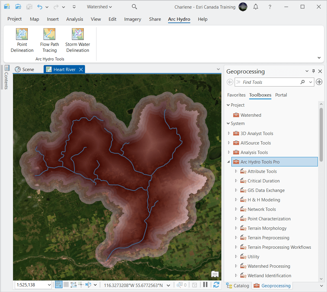
When you install Arc Hydro, you will find over 200 tools in the Arc Hydro Tools Pro toolbox. The add-in Arc Hydro tab has shortcuts to three of them. As shown on the figure, some of the resulting features stored in the data model are drainage lines (i.e. rivers and streams) and drainage areas (i.e. watersheds and subwatersheds).
As indicated by the titles of the various toolsets, Arc Hydro supports generating and working with hydro networks, hillslope-controlled critical duration, terrain morphology and preprocessing, watershed processing, wetland identification and data interchange for H&H modelling. You will likely only use a couple dozen of these Python-based tools to develop your specific integrated analytical system for water resources.
The Arc Hydro GIS for Water Resources webpage has abundant guides, technical papers and recorded webinars ready for whenever you need to integrate raster, vector, tabular and network data into an efficient and consistent modelling foundation that you can extend and configure for your specific GIS implementations of water resource analyses. Your water bodies and watersheds may not be heart-shaped, but you will be well taken care of by Arc Hydro (and despite what W.H. Auden said) live with both love and water!
To inspire you, here are even more quotes about water from artists and scientists that span the centuries:
- “Nothing is softer or more flexible than water, yet nothing can resist it.” —Lao Tzu, Tao Te Ching (4th century BC)
- “Water is the driving force of all nature.” —Leonardo da Vinci, undocumented (16th century AD)
- “A drop of water, if it could write out its own history, would explain the universe to us.” —Lucy Larcom, The Unseen Friend (1892)
- “If there is magic on this planet, it is contained in water.” —Loren Eiseley, The Immense Journey (1957)
- “No water, no life. No blue, no green.” —Sylvia Earle, Address to the United Nations (2015)
Want to dive deep into Arc Hydro with the support of an expert? Our instructor-led Arc Hydro course, Surface Water Analysis and Arc Hydro in ArcGIS Pro, will give you everything you need to get started with water resource analysis and modelling in ArcGIS.
Want to stay informed about all the latest training opportunities at Esri Canada? Visit Esri Canada’s Communication Preference Centre and select the “Training” checkbox to get a monthly roundup straight to your inbox.