Geographical Thinking: Episode 98 – Whales or Whitecaps?
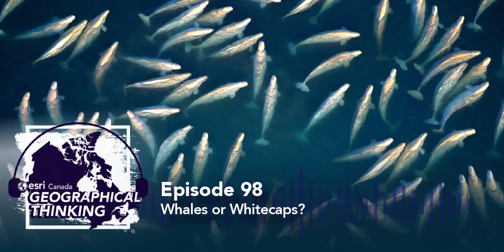
In this episode of the Geographical Thinking podcast, host Michelle Brake is joined by Mohamed Ahmed, lead data scientist at Esri Canada, for a conversation exploring how AI is transforming marine conservation. Fisheries and Oceans Canada collaborated with Esri Canada to train deep learning models to detect beluga whales in Arctic waters using aerial, drone and satellite imagery.
With accuracy rates of 85–88%, these models can analyze thousands of images in hours, a task that previously took months. Mohamed shares insights into the challenges of distinguishing whales from ice, the evolution of these AI models and what this breakthrough means for the future of marine research. Tune in to discover how technology is helping us better understand Arctic ecosystems and the impact of climate change.
Looking for resources on what we discussed in today’s podcast? Check them out below!
Connect with Dr. Mohamed Ahmed on LinkedIn to stay up to date as this project continues!
Beluga Whale Detection using Deep Learning (AI): Check out this ArcGIS StoryMaps story to learn more about the work being done by Fisheries and Oceans Canada and Esri Canada to develop deep learning models for detecting beluga whales in Arctic imagery.
ArcGIS Living Atlas Deep Learning Tools: This section of the ArcGIS Living Atlas offers a variety of deep learning packages designed to enhance spatial analysis and geospatial modeling capabilities.
State of the Arctic Ocean Report 2023: This report provides updated insights into the health and status of Canada's Arctic marine ecosystems, compiled collaboratively by Arctic communities, Inuit organizations, academia, NGOs, and Fisheries and Oceans Canada.
Esri Canada Higher Education and Research: Esri Canada's Higher Education and Research group supports academic institutions by promoting GIS in teaching, learning and research, fostering innovation and collaboration across disciplines.
![]()
![]()
![]()