City of Kelowna receives Esri Special Achievement in GIS
Canada’s fastest growing city recognized for meeting the challenges of growth using geographic information systems
SAN DIEGO, Calif., Esri User Conference—July 18, 2024—Esri Canada congratulates the City of Kelowna for receiving the 2024 Esri Special Achievement in GIS (SAG) Award. The City was selected from thousands of Esri customer organizations worldwide for their outstanding use of geographic information system (GIS) technology to support their Intelligent City Strategy— creating a better city and improving the lives of their constituents.
“Kelowna faces similar challenges that big cities have such as affordable housing, infrastructure costs, climate change and maintaining transparency, but these become even more challenging because of the City’s unique topography,” said Alex Miller, president, Esri Canada. “Organizing and analyzing their data in the crucial context of location positions them well for collaborative innovation to meet the needs of their growing City.”
Kelowna’s population grew to 150,000+ in 2021 (up 13.5% from 2016) and is expected to be around 230,000 by 2040. Its stunning lakes, streams, mountain ranges and valleys provide a unique landscape that draws people to live in the community. However, these natural features limit the land area for development and also make the City prone to natural hazards including flooding, landslides and wildfires.
“Our City faces complex issues that are driving the shift from becoming a smart city to an intelligent city,” said Cheryl Trent, data services & analytics manager, Information Services, City of Kelowna. “Using Esri’s comprehensive geospatial platform enables us to advance digital transformation and automation of key City processes across departments in support of data-driven decision making.”
Enabling faster, smarter planning and development
Building 36,000 housing units to accommodate 70,000 more residents by 2040 is part of the City’s Official Community Plan. To better plan for growth, Kelowna created Model City, a parcel-based digital twin data model. It uses Esri’s ArcGIS technology to integrate disparate data and provide a comprehensive picture of what Kelowna looks like today, tomorrow and in the future.
“Before Model City, the City would use external consultants to generate a growth projection as part of our Official Community Plan. This process would take weeks or even months,” said Kevin Stehle, business systems analyst, City of Kelowna. “Now with the City’s GIS-based digital twin, we can build multiple growth scenarios in hours to understand the tradeoffs of various growth options.”
Engaging citizens in community development
The City released Explore3D Kelowna, which enables citizens to ask questions about planned developments in the City’s urban centres and receive immediate, up-to-date and complete answers. Citizens can use insightful 3D tools to see different scenarios—e.g., how their community would appear if buildings were higher or lower than proposed. The app helps the City overcome development challenges, effectively manage and synthesize large data repositories, and improve community engagement.

The public can use Explore3D Kelowna to see planned development in the city using insightful 3D tools.
"The Esri Special Achievement in GIS Award is not just a recognition of our City's innovative use of technology; it's a celebration of our collective spirit and determination to make Kelowna a smarter, more connected community,” remarked Ms. Trent. “This award is a testament to the hard work and creativity of our team, and it propels us further towards our goal of transforming the way we live, work and play in our beautiful city."
Read more about City of Kelowna’s use of GIS technology
About City of Kelowna
Located on the traditional, ancestral, unceded territory of the syilx/Okanagan people, Kelowna is a vibrant mid-sized city in the southern interior of British Columbia, Canada. It is situated in the heart of the Okanagan Valley, surrounded by mountains, lakes and vineyards. With a population of over 160,000 people, it is the largest city in the Regional District of Central Okanagan. Kelowna’s diverse economy includes a mix of industries such as agriculture, manufacturing, retail trade, construction, technology, healthcare and tourism. Kelowna’s natural environment is a cornerstone of its identity, supporting the community’s health, economy, and livability. This, coupled with a diverse economy and vibrant arts and culture scene, bolsters a strong sense of community and high quality of life. More information can be found at kelowna.ca.
About Esri Canada
Founded in 1984, Esri Canada provides geographic information system (GIS) solutions that empower people in business, government, and education to make informed and timely decisions by leveraging the power of mapping and spatial analytics. These solutions enable organizations to better manage their resources, plan their future and collaborate within and beyond their organization. Esri Canada’s products and services help advance successful digital transformation. The company serves more than 14,000 organizations from 13 offices across Canada and is based in Toronto. Esri Canada has been recognized as one of Canada’s Best Managed Companies for 12 consecutive years. More information can be found at esri.ca. Follow Esri Canada on X (Twitter), Facebook, YouTube, Instagram and LinkedIn.
For media inquiries, please contact:
City of Kelowna
Tom Wilson, Media Relations Manager
twilson@kelowna.ca
Esri Canada
press@esri.ca
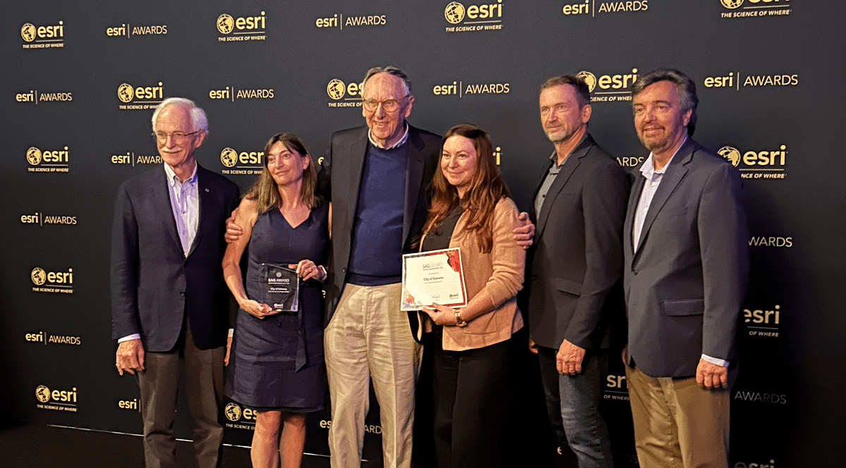
(From left to right): Alex Miller (President, Esri Canada), Cheryl Trent (Data Services & Analytics Manager, Information Services, City of Kelowna), Jack Dangermond (President, Esri), Naomi Pears (Business Systems Analyst, City of Kelowna), Steve Schmeeckle (Senior Account Manager, Esri Canada) and Myron Doherty (Director, Pacific Region, Esri Canada)