Future-Ready Approach to Dam Safety Risk Decisions at BC Hydro
In dam safety, the biggest risk is not having the full picture. BC Hydro unified its data, models and monitoring so engineers can act in minutes instead of days, enabling earlier detection and smarter decisions. See how they did it.
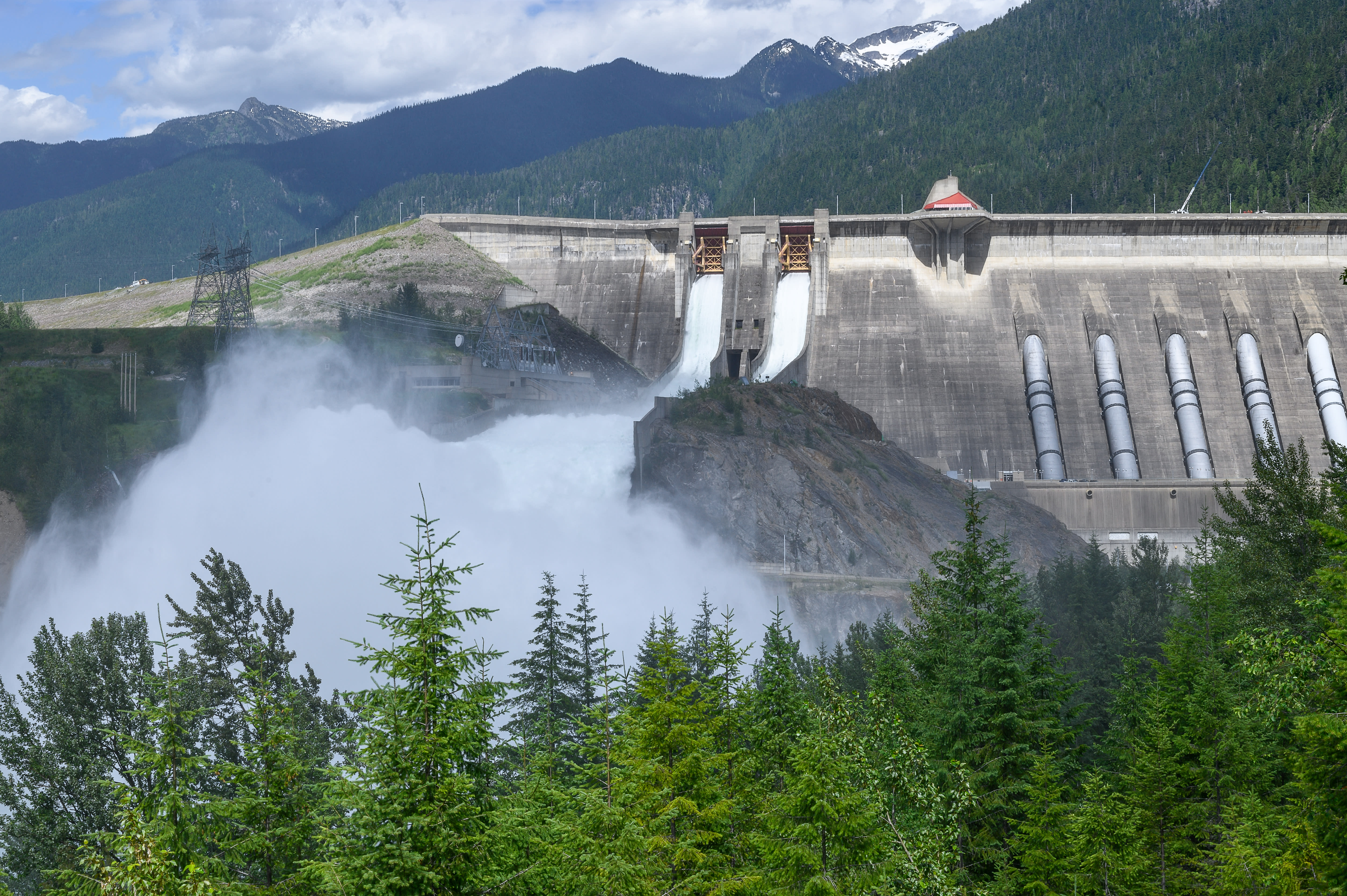
Revelstoke Dam spillway near the City of Revelstoke in British Columbia, Canada.
Challenge: Critical Dam Data Gaps
BC Hydro’s dam safety program manages 82 dams across British Columbia, each with decades or even a century of historical data. Information was stored across documents, drawings, surveys, instrumentation systems and environmental records.
“Engineers were spending hours, sometimes days, just gathering the information they needed before they could even start analyzing it.”
~ Forrest Wagner, Data Technology Lead, Dam Safety Technology team, BC Hydro
Staff had to assemble this information manually from multiple systems before they could analyze conditions at a site, creating delays. At the same time, an aging workforce created pressure to capture and transfer knowledge more effectively to newer staff.
Legacy assets meet modern data expectations
A century of records, from paper drawings to modern models, made it difficult to access and use dam data consistently. Teams needed a reliable, complete view of each site to support and expedite risk decision making.
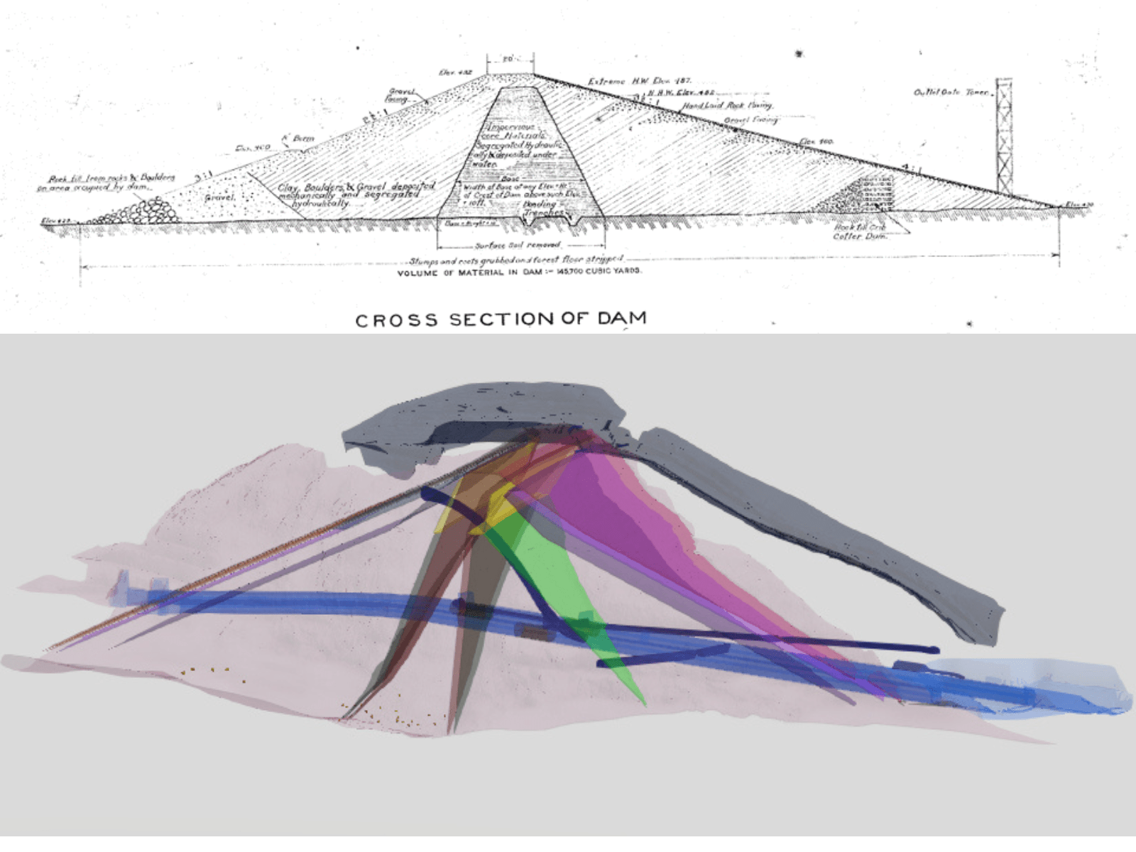
(Top image) Historical hand drawing of the cross-section of a dam and (Bottom image) modern 3D models show the evolution of dam data over time.
Solution: Connecting Systems and Data
BC Hydro built the Dam Safety Information System (DSIS) to bring together engineering, operational and environmental data in one place. This connected geographic information system (GIS) solution uses Esri ArcGIS tools, custom APIs and data integration tools including Feature Manipulation Engine (FME).
“GIS fit the need. It gave us the ability to bring together data from multiple systems into a single unified user experience.”
~ Forrest Wagner, Data Technology Lead, Dam Safety Technology team, BC Hydro
One system, complete visibility
The application provides a map-based view that combines 2D, 2.5D and 3D models with operational data such as inspections, instrumentation readings, imagery and natural hazards.
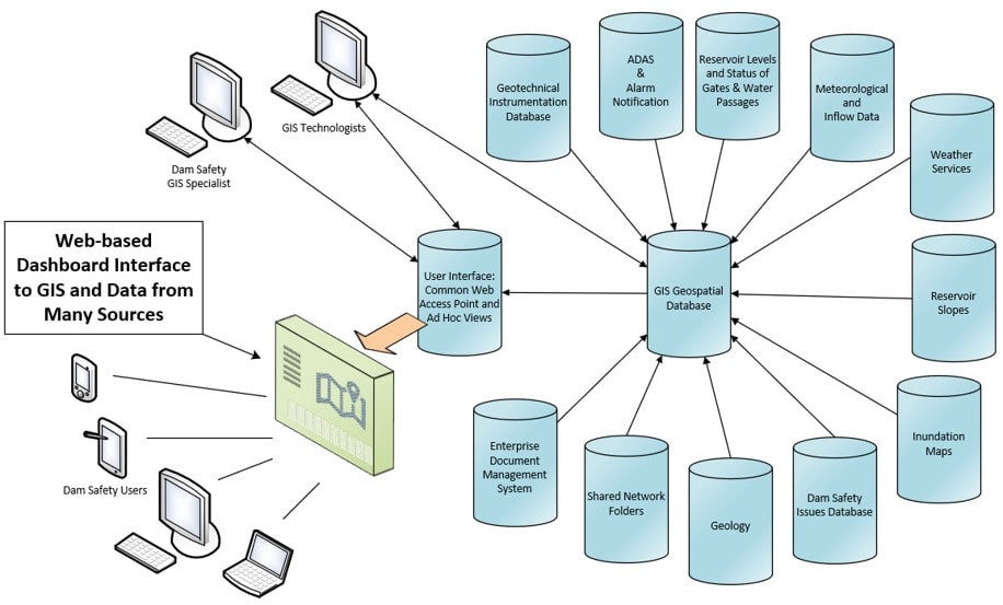
A centralized GIS platform connects monitoring, operational, environmental and engineering data into a single web-based ArcGIS Dashboard for dam safety analysis.
ArcGIS Enterprise serves as the foundation for delivering and managing this information, while ArcGIS Pro supports the creation, analysis and maintenance of geospatial data and 3D models. ArcGIS Server, along with custom APIs and data integration tools, delivers this content in a unified interface that supports both high-level decision-making and detailed engineering analysis. Simplified 3D models balance clarity and performance while helping users understand each site in context.
Fujitsu Canada partnered with BC Hydro to help implement the integrated architecture that connects systems and delivers a consistent user experience across devices. As Wagner noted, Fujitsu Canada’s Alejandro Mari has been a key technical contributor, supporting complex system integrations, application functionality and the continued growth of the GIS platform.
A practical approach to 3D and digital twins
The team explored full digital twin concepts early in the project. Experience showed that dam safety needed a fit-for-purpose view rather than massive Revit models. The system now uses simplified 3D models that load quickly and support clear analysis. This shift reflects what the team learned about performance, usability and the needs of dam safety staff.
Growing interest in Autodesk and GeoBIM
As BC Hydro delivers more capital projects, growing use of Autodesk tools like Construction Cloud has led to new exploration of GeoBIM workflows, creating opportunities to connect design and operational data more effectively.
Driving adoption: Scavenger hunt
Early adoption was low. Staff were busy and unsure how to explore the new system. To help users onboard, the team introduced a scavenger hunt with simple daily tasks that guided staff through the system’s features. This hands-on approach improved confidence and helped users discover how the system could support their work.
Benefits: Clear, trusted data for better decisions
- Faster risk decisions by reducing time spent gathering data
- Better data quality and governance across systems
- Stronger collaboration between teams
- Simplified access to information through a single interface
- Support for future innovation including 3D models and expanded integrations
“GIS didn’t just change our tools, it changed how we work… This transformation has positioned us to respond faster, innovate more and operate with confidence.”
~ Forrest Wagner, Technology Lead, Dam Safety Technology team, BC Hydro
BC Hydro’s experience shows that technology alone is not enough. Success requires clear governance, strong integration and practical approaches to user adoption. With the right foundation, organizations can simplify complex data environments and unlock new use cases over time.
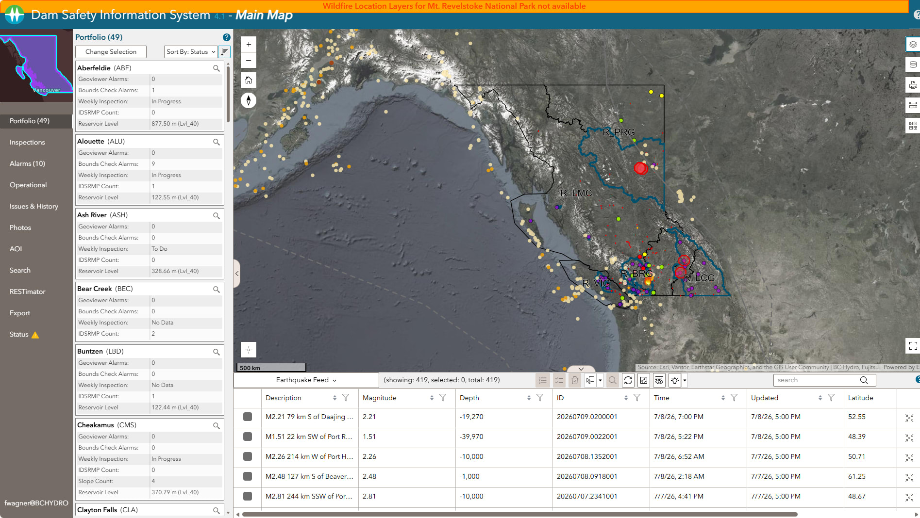
User view of the main map in the DSIS interactive dashboard showing dam assets, monitoring alerts and site information across British Columbia.
Results: Faster analysis, broader adoption
BC Hydro’s dam safety team can now complete tasks in minutes that once took hours or days. Teams work from a complete view of each site, helping new staff onboard quickly and enabling experienced staff to share knowledge across the organization.
New use cases are emerging across BC Hydro. Engineering teams are using the system to support project planning and estimation, while staff can export summaries directly from the application to support small work packages. Other groups are seeing value in the shared view and exploring how to connect their data.
Leadership visibility has also increased. The application has been demonstrated to executive teams and is used to support discussions about risk, operations and planning.
From Insight to Action
With a unified system in place, dam safety teams operate with immediate access to trusted information across every asset.
For utilities, this creates a clear advantage. Decision makers gain a system-wide view of risk and performance, while engineers move directly into analysis with confidence in the data. The result is better decisions that support safety, reliability and long-term asset management.
BC Hydro built a strong data foundation that supports advanced modeling and expanded use across the organization for future growth.
Congratulations to the BC Hydro team on receiving the Esri Special Achievement in GIS (SAG) Award, recognizing their leadership in advancing dam safety through innovation and strong data practices. Read more about BC Hydro's award-winning work in our news release.
Learn more
Esri Canada utilities: esri.ca/electric
BC Hydro: bchydro.com
See inside BC Hydro – GIS Day in Canada Dam Safety Information System presented by Forrest Wagner and Alejandro Mari.
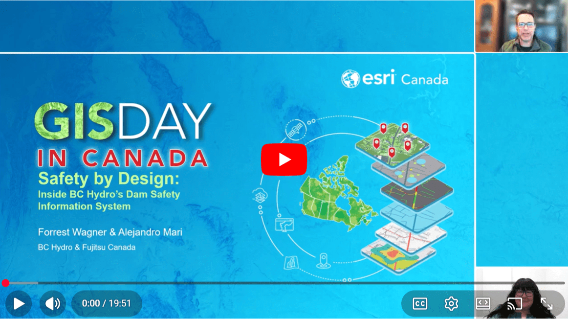
BC Hydro shares how the DSIS uses GIS to unify data, improve decision-making and enhance dam safety across British Columbia.
Let’s hear your story!
Have you used GIS or a partner solution to solve a challenge or improve your organization? We would love to showcase your success and inspire others. Share your experience and contribute to industry knowledge with a GIS Success Story.