Understanding and Strengthening Indigenous Communities using GIS
June is National Indigenous History Month in Canada. Looking to engage your students in discovery? Explore stories on how geographic information systems (GIS) is being used in Indigenous communities by blending ancient wisdom with modern tools.
In honour of this special month, we've gathered resources and inspiring stories showcasing the versatile applications of GIS in Indigenous communities. These narratives highlight the fusion of Traditional Knowledge with modern technology, empowering Indigenous peoples to map their lands, address environmental challenges, and shape a sustainable future. Join us in celebrating their rich heritage and contributions to cultural preservation and community development.
K-12 education resources and stories
Explore a collection of ArcGIS resources and inspirational stories for K-12 educators.
On the Map with Six Nations Polytechnic STEAM Academy
Using ArcGIS Online, students at the Six Nations Polytechnic STEAM Academy retold the story of the Peacemaker, who established The Great Law of Peace among the Hodinohso:ni Nations during times of war.
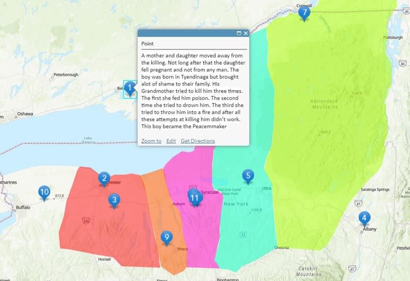
ArcGIS Online was a visual tool to help students recall the Peacemaker's journey through Hodisononi History. The students created resources for staff and students about this important story.
L’nu Place Names in New Brunswick Web Map
This web map showcases geographic features and landmarks that reflect the kinship between L’nu, a Mi’gmawe’l word meaning “the people” and their environment. Explore New Brunswick’s names of watercourses and landmarks through the lens of the original inhabitants: Mi'gmaq, Wolastoqiyik and Peskotomuhkati nations.
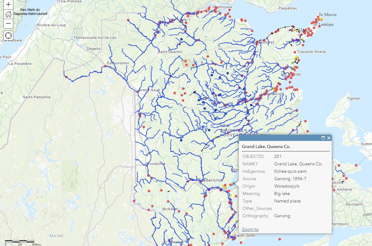
In this web map, you will discover New Brunswick’s watercourses and landmarks through the lens of the original inhabitants: Mi'gmaq, Wolastoqiyik and Peskotomuhkati nations. Learn more about the map.
Indigenous Territories
The Native Land Digital data layer displays Indigenous lands in a way that changes, challenges, and improves the way people see history and the present day. The hope is to strengthen the spiritual bonds that people have with the land, its people, and its meaning.
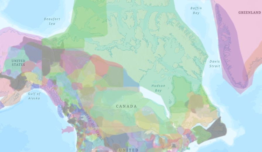
A layer of Indigenous land territories across the globe, provided by Native Lands Digital.
Indigenous Knowledge and Land Management
The following stories highlight not only how GIS is being used but also possible careers for students.
Documenting Indigenous Knowledge and Traditional Values using GIS
In this video, Jennifer Duncan of the Four Rivers Environmental Services Group, located in Thunder Bay, ON discusses Matawa First Nations Management's map "Watersheds within the Matawa Homelands and Traditional Territory". Watch the video to learn more about Matawa First Nations Management, the genesis of the map and what Jennifer's plans are for this map in the future.
Anishinabek Nation: Advancing Indigenous land management with GIS
Meet Rhonda Gagnon, manager of lands and resources for the Anishinabek Nation. Discover how GIS technology helps preserve cultural heritage, manage resources and foster community collaboration. Watch the video to learn how Rhonda's dedication to training and capacity building transforms land management for future generations.
GIS in Mining: Strengthening Indigenous Communities
In the heart of Canada's mining landscape lies a crucial barrier: how can communities effectively engage with and understand the complexities of mining processes? This question forms the crux of our dialogue with Jenny Campbell, a Policy Analyst deeply engaged in the Anishinabek Nation's community development and mining resource management.
Looking for more stories?
Explore the Esri Canada Indigenous Stories page with blog and videos of GIS use in communities across the country.
Have a Mappy Indigenous History Month!