10 Takeaways from the Esri User Conference for K-12 education
The annual Esri User Conference was virtual this year. The K-12 group has put together a list of 10 takeaways (not the typical swag we are used to) from this year’s event. Discover new apps or just try out the new features on apps and software you are already using!
This year’s Esri User Conference (UC) was hosted virtually for the first time with over 85,000 attendees from all over the world! It was an amazing learning opportunity that can be experienced again or for the first time through the recorded sessions:
- Esri UC Plenary Sessions
These are powerful presentations that show you how GIS is used to make importance
decisions and connects our world. - Tech Sessions –Some of these will be available in the near future. Check the Esri UC site for updates. Those who registered, can continue to access the recorded sessions.
Jack Dangermond, Esri’s President talking about the importance of Education at the Esri User Conference, July 2020. “I really enjoyed the plenary sessions. Jack Dangermond's opening remarks were very thoughtful and demonstrated a real sense from the top down of Esri's commitment to making a real difference in our interconnected world. The ArcGIS technology and applications highlighted in the second plenary showed the utility of GIS across a variety of fields and disciplines.” – Dr. David Joiner, St Andrew’s College.
After attending plenary and technical sessions at the Esri UC, we put together the top 10 takeaways for K-12 education. With this list, you can check out new features in apps that you’re already using or try out new apps and resources that pique your interest!
-
ArcGIS Living Atlas – Indicators of the Planet
Indicators are updated with near real-time information contributed in the Living Atlas by organizations such as NOAA, UN Environment Programme, and the US Geological Survey. 18 topics are covered, with more being developed. In addition to the summary statistics provided on the GeoCards, there are a series of maps and resources to better understand each issue.ArcGIS Living Atlas – Indicators of the Planet – include GeoCards that are a good way to engage your students in a discussion, or to discover a global issue that they would like to explore further.
- Custom Basemaps
Basemaps not only give context to our data, they can be the main event! Basemaps are available in 24 languages and you can change basemap layers to be a reference layer. This allows you to set the visibility range for basemap layers and edit the transparency. You can even change the style of a basemap in the map viewer by using the vector tile style editor. This really lets your students customize and personalize their maps. Designing a custom basemap would make a great art project.
Create your custom basemaps with this vector tile style editor.
- The Living Atlas
This is not your typical atlas. Explore data, maps and apps that are ready for you to use and for your students to explore. We discovered a few of these below:
- ArcGIS Experience Builder
This app, that you access through ArcGIS Online, allows you to quickly transform your data into compelling web apps without writing a single line of code. Build mapcentric or nonmapcentric apps and display them on a fixed or scrolling screen, on single or multiple pages. You can also integrate 2D and 3D content and select designer templates or create your own.
@EsriUC #2020 #ArcGISExperienceBuilder #techsession - looking forward to trying this! #nocoding required!@GISAmbassador @GIS4Teachers pic.twitter.com/qASiIf2K9s
— Angela Alexander (@AngeAlexander88) July 15, 2020
- ArcGIS StoryMaps
There are recent updates to check out that include more options to customize your story map and share your work. Now you can include audio, create collections and try out the new swipe block. Learn more about the updates and upcoming features in the ArcGIS StoryMaps Road Map for 2020.
#ArcGISStoryMaps Roadmap: What's next for the rest of #2020? Check out the #newfeatures that are coming and have been added. https://t.co/bzt6jB0BUS #SummerActivity #SummerStoryMap #DocumentSummerFun #RemoteLearning #Learningathome @GIS4Teachers @GISAmbassador pic.twitter.com/LbcCmqfuwl
— Angela Alexander (@AngeAlexander88) July 15, 2020
- Survey123
Web Designer updates include the ability to add a ranking question and a map question replaces the “geopoint” question that now supports submitting either a point, line, or polygon. - ArcGIS Notebooks (ArcGIS Online)
Students can use ArcGIS Notebooks to develop their coding skills linked to spatial analysis and STEAM in the curriculum. Access Notebook by signing into ArcGIS Online. Try this beginner tutorial - you'll learn some Python commands to map and visualize data.
Access ArcGIS Notebooks in ArcGIS Online
- ArcGIS Online Map Viewer Beta
This is the biggest update to ArcGIS Online, as the map viewer is where we make our maps, analyse data and much more! The Map Viewer Beta is available now to try out and it’s the next generation in map making. There are many symbology options, the ability to create field selections and search a feature for a field. It will be the Map Viewer default in late fall, but the current version will be available into 2021.
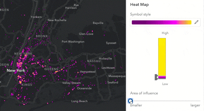
The Map Viewer Beta offers many symbology options like heat ramp colours.
- Analysis in ArcGIS Online
Use analysis tools in ArcGIS Online to explore relationships, patterns, trends in spatial data, as well as a way to learn about science, public health, social issues, geography, and much more. Try a tutorial. - Science Symposium
This is a favourite of the K-12 group and others at Esri Canada. This year Canadian climate scientist Katharine Hayhoe inspired us with her presentation on the importance of talking about climate change and understanding the science and data behind it.
@EsriUC #ScienceSymposium. A very engaging presentation by @KHayhoe! Check out #HotNumbers #StoryMap - Human impacts that are warming our climate! https://t.co/viDnLyN7si We need to #understandthescience @GIS4Teachers @GISAmbassador @deepseadawn pic.twitter.com/sHK59zFKw7
— Angela Alexander (@AngeAlexander88) July 16, 2020
The Science Symposium is the highlight of the Esri UC every year! The engaging talk was tweeted by many professionals in the GIS community from all over the world.
Bonus takeaways include:
- Esri and National Geographic’s Partnership
Jack Dangermond welcomed Dr. Vicki Phillips, Executive Vice President & Chief Education Officer of the National Geographic Society. Together, they discussed how the National Geographic Society and Esri are leveraging each organization's unique strengths to develop resources that empower a generation of solution seekers. Learn more about how this partnership increases the collective impact of each organization and showcases the many ways geography and spatial thinking play a vital role in multidisciplinary education. Check out the talk from the Esri UC - National Geographic Society - A Conversation on Education.
- Jeffrey Sachs’ talk at the Day 3 Plenary
Jack Dangermond welcomed Jeffrey Sachs, who shared his vision on how timely data can help us drive progress on the global Sustainable Development Goals – and inspired everyone to engage deeper with information to interconnect society for a more sustainable future. Watch the talk from the plenary.
Explore the Digital Swag Bag that’s full of cool and fun items! Unfortunately, this year we didn’t have a chance to grab those cute buttons at the Esri UC.
Download these awesome backgrounds from the Digital Swag Bag!
Looking for another conference to attend this summer? Register for the Esri Education Summit on August 6-7 now. K-12 sessions run 3:00-6:30 Eastern Time on both days.
We would like to hear from you. Let us know what your takeaways are from the Esri UC were by commenting below.
This post was translated to French and can be viewed here.