Spark Learning with ArcGIS: Winter Edition
Happy Winter! We have some cool ArcGIS ideas and resources for you to celebrate the chilly season with your students without stepping outside. In addition, discover software updates and event proceedings from the Fall conferences, and much more.
Activity Ideas
In class exploration
These activities can be done in the classroom or at home.
Spread Creative Joy
Winter can be a season when we all need a touch of creative inspiration. In this activity, we invite students and teachers to share creativity in any form that moves them. It could be a poem, a painting, a story, an ArcGIS web map, an ArcGIS app, or any other creative outlet that brings you joy! This can be something you created or someone else’s work. Just remember to credit the work.
Use the survey embedded in the ArcGIS Dashboard to upload a picture of the art or include a link to the ArcGIS content. All submissions will be showcased in an ArcGIS Dashboard where everyone can explore and celebrate creativity and the joy it brings us.
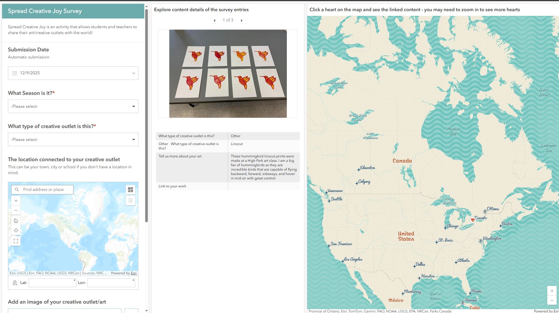
Add your entry to the survey, refresh the dashboard to see your content and it will be shared for everyone to see.
Canada’s Natural Wonders
Travel virtually through Canada to discover the Indigenous stories and geological processes of unique landforms in Canada. This resource was created by the winner of the New Educator Award.
GeoProjects from Esri (Grades 4-12)
Explore the collection of ready-to-use resources that are project-based learning with maps and require no log-in. Read more about them from this Esri Community post.
Do it yourself exploration
ArcGIS Survey123: Map winter activities and events
Using ArcGIS Survey123, students can design their own survey to collect data about winter activities and events that happened, or are happening, in their region. Question types that you can include:
- When – Date
- What - Activity/Event Type (Dropdown or Single select)
Examples: Snowboarding, snowshoeing, skating, downhill skiing, winter festival, holiday party, Christmas market, winter outdoor concert, cross-country skiing - Where – Location (Map)
- Why – Details about why you like this activity/event (Multiline text)
- Image - Option to add an image
Mapping Corner
Classic Story Maps are retiring this quarter!
Preserve the relevant content you created in the classic versions and learn how to migrate it to ArcGIS StoryMaps. Read about the retirement.
The latest What’s New with ArcGIS (Fall edition)
Explore some of the latest enhancements:
Maps, Apps, Events and more!
This past Fall was a busy time with in-person conferences that highlighted GIS everywhere for everything!
Esri Canada GIS in Education and Research Conference
Our 6th biennial conference was held on October 16th, 2025, if you missed it check out the Key Takeaways from the conference and the K-12 workshop materials.
Esri Canada User Conference
This conference is back and even better after 6 years! It’s Canada’s largest national GIS event that brought professionals and educators together to explore how GIS is shaping our world. From plenary talks to technical sessions and special interest groups, the conference highlighted how GIS transcends boundaries, integrates knowledge and data, and empowers people to drive positive change.
Watch the K-12 presentation featuring students from David Suzuki Secondary School in Brampton, Ontario, as they showcase their GIS project identifying the best place to live in Canada using ArcGIS.
Check out the conference proceedings, presentations and resources if you missed the event.
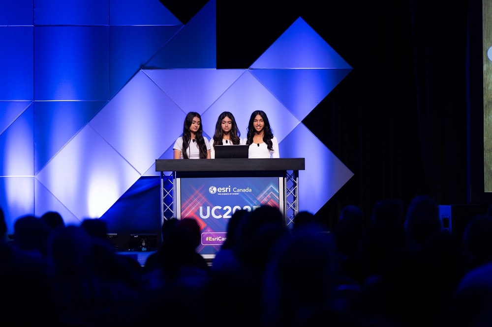
Manseerat, Michelle and Bhadra– students from David Suzuki Secondary School presented their grade 9 project to a large crowd of GIS professionals at the second day of the Esri Canada User Conference on November 4th, 2025.
New to ArcGIS?
K-12 educators in Canada can sign up today at k12.esri.ca. Begin your journey with the following resources:
Let’s get started with ArcGIS Online
Self-guided learning resource for K-12 educators.
ArcCanada Atlas Activity Collection
Explore and understand national and global geography, history, and culture through interactive activities and create maps.