On the Map with Danny Kajan
This month’s On the Map features Danny Kajan, a geography teacher from Strathroy, Ontario. Learn how his students have enhanced their outdoor environmental education through ArcGIS Online.
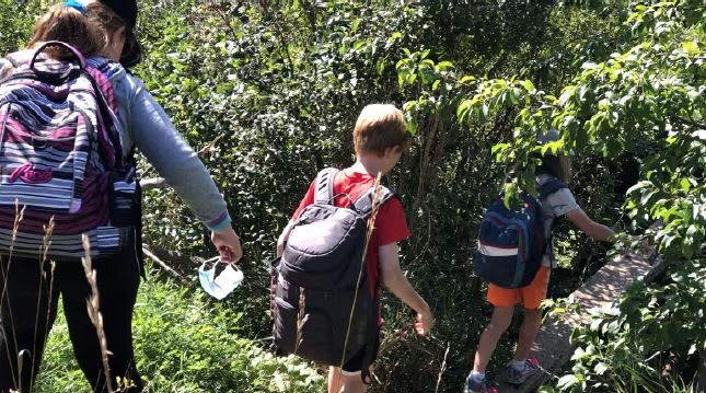
Danny teaches the Environment and Resource Management course combined with Spatial Technologies as a two-credit course that integrates outdoor environmental education (OEE) at Strathroy District Collegiate Institute. Students engage in real-life projects such as habitat restoration in collaboration with environmental organizations. They also have certification opportunities that include canoe skills, wilderness first aid and CPR, GPS, species identification, and map and compass skills. Students in the course dedicate half their day in preparation for careers in outdoor and environmental fields.
The K-12 group at Esri Canada has a longstanding relationship with Danny, spanning many years of engagement at professional development days, conferences, and the annual Skills Ontario GIS competition. Danny has supported and guided students from his school to participate in this event in previous years.
 Danny Kajan has been using ArcGIS Online for teaching and student learning for many years now.
We recently connected with Danny to learn more about how he integrated ArcGIS Online in the OEE program.
Tell us how you are using ArcGIS for the OEE program
In our OEE program, we integrate ArcGIS Online to enhance learning through practical applications. For instance, students engage in ground truthing activities where they measure our school yard features and verify their findings using topographical maps in ArcGIS Online, facilitating a hands-on understanding of geographical concepts. This year, one of my students used ArcGIS Online to map skateboarding routes in Strathroy for their final independent study project (ISP), identifying suitable paths and highlighting roads unsuitable for skateboarding.
My students also used ArcGIS Online to identify and map habitats needing restoration. This hands-on experience helps them understand ecological principles and gives them a taste of how GIS is used in the environmental science and conservation sectors.
Benefits of ArcGIS Online
I believe these projects not only deepen students' spatial analysis skills but also demonstrate the tool's versatility in studying real-world environments and urban planning considerations. By incorporating ArcGIS Online into our OEE program, we empower students to explore and engage with their surroundings in innovative ways, bridging theory with practical application.
 “With many different opportunities in the world, ArcGIS Online is one of the most important things to know. Without even realizing that you use GIS in your everyday life”. - OEE Student, 2024
Why do you feel ArcGIS Online is a good tool for the courses you are teaching in geography?
ArcGIS Online is invaluable in our courses because it allows students to explore the world virtually, increasing their spatial knowledge, and analyzing geographic issues without physical travel. It allows them to create personalized web maps on topics of interest, fostering engagement and deeper understanding. Using ArcGIS Online also cultivates essential troubleshooting skills as students navigate the software and collaborate in teams to tackle challenges. Overall, the software enhances our curriculum by providing practical, hands-on learning experiences that prepare students for future endeavours in geography and spatial technologies.
What has the student feedback been?
The feedback has been very positive as the students enjoy the work they are doing in ArcGIS Online. They find it engaging to work with a tool that allows them to learn so much. From monitoring weather patterns and forest fires to understanding environmental topics like endangered species, deforestation and much more. They also enjoy the GIS Day event they attend that is hosted annually by Western University. I believe this event gives them a deeper appreciation of how GIS is used in education but is also a tool applied to understand and solve problems in different industries.
Thank you, Danny, for sharing your students’ ArcGIS Online experience. We hope to hear more about the work you’re doing in the new school year.
Are you an educator looking to get started with ArcGIS Online?
Request an ArcGIS Online for you and your students at k12.esri.ca.
For Educators - Let's get started with ArcGIS Online
Explore the Frequently Asked Questions (FAQ)
For Students - Enroute with ArcGIS Online
Explore the Esri Canada's K-12 Resource Finder to find more resource for your ArcGIS journey!
Happy Mapping!