Community Map of Canada Spotlight: Oro-Medonte and their Heritage Story Map
The Township of Oro-Medonte, a small community focused on building interactive relationships with their public, has created a Heritage StoryMap you won’t want to miss.
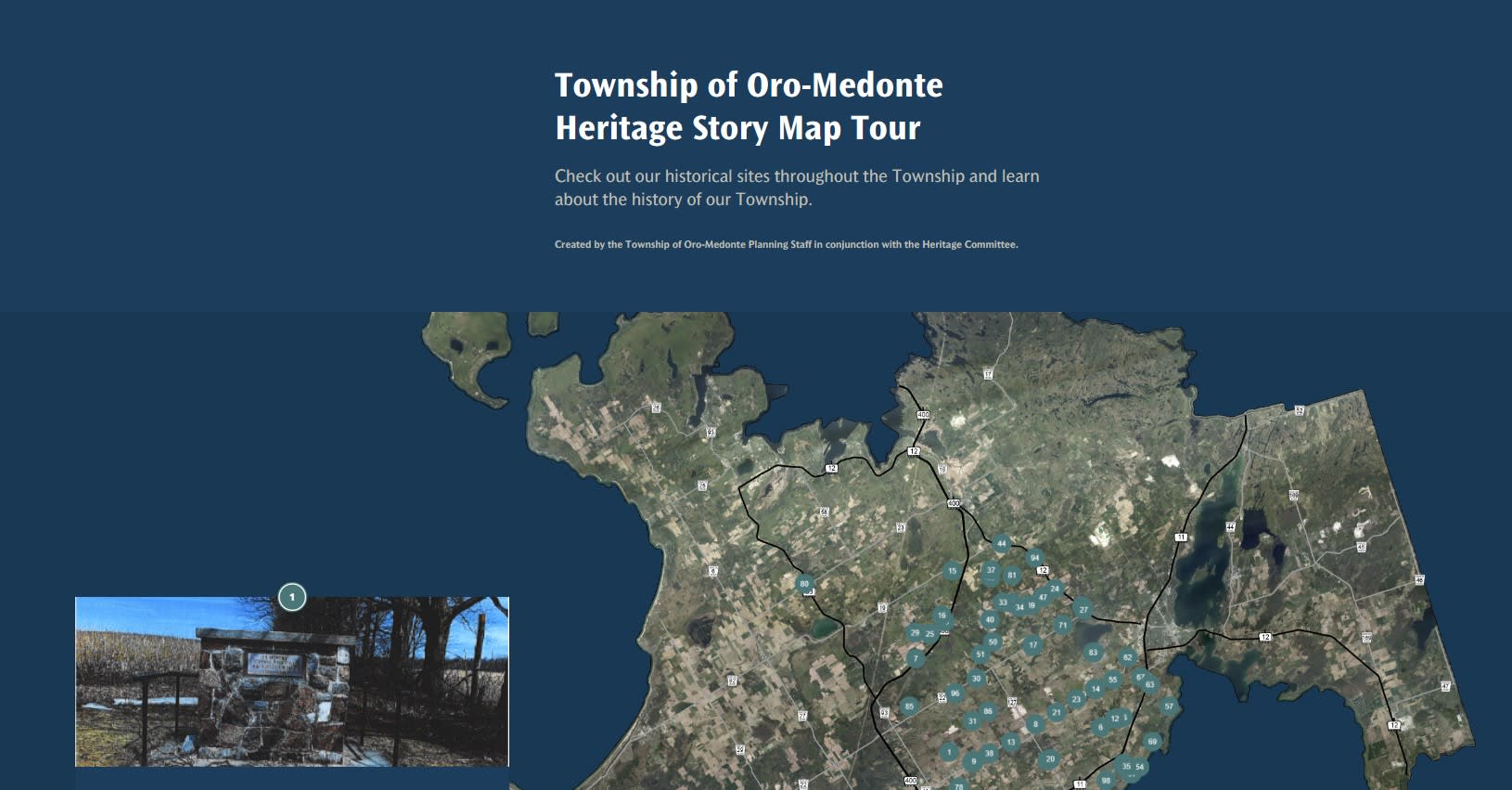
The community of Oro-Medonte, a Community Map of Canada contributor, has perfectly mixed together storytelling and geography with their creation of an ArcGIS StoryMap called, ‘Township of Oro-Medonte Heritage StoryMap Tour’ with many more exciting projects following closely behind.
Paul Zhao, GIS analyst for the Township is an avid supporter of using GIS to effectively tell stories and engage the public. The Township of Oro-Medonte’s planning staff and Heritage Committee started this particular project of documenting heritage sites through the township in 2020, initially using ArcMap before transitioning to ArcGIS Online. After the transition, Paul discovered the possibilities of telling this story in new and exciting ways and he decided to take full advantage of the new technologies made available to them.
Oro-Medonte has a rich cultural heritage dating far back to when the area was inhabited by predominantly the Huron Peoples. Since then, many historical artefacts and sites have graced the land, with European exploration and settlement also leaving behind historical artefacts. With such a historical area, it is important to tell the story of all that came before, and this Heritage StoryMap does just that.
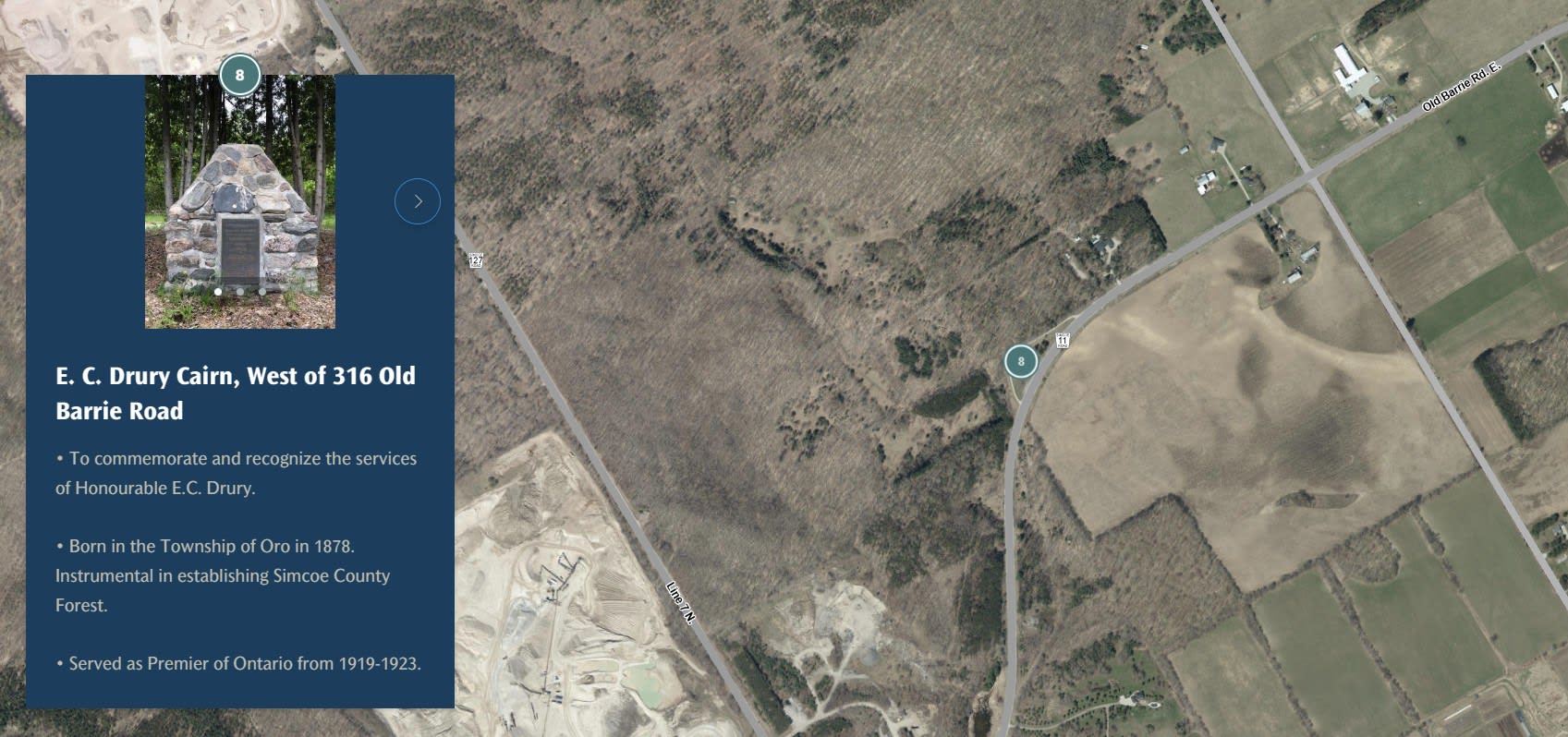
Paul created the interactive Heritage StoryMap that that allows residents to locate the Township’s heritage listed and heritage designated properties, plaques, monuments, cairns, churches, and cemeteries.
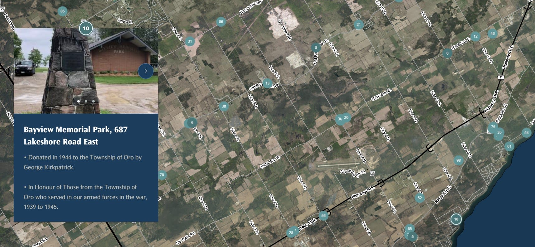
The details included for each site include photos, name of the site, address, date listed/designated, Heritage Committee and Council motion numbers as well as a brief description of the point of interest. The StoryMap can be accessed through desktop computers, mobile phones and tablets, via the Township’s Maps Page.
Since this initiative was created in ArcGIS StoryMaps via ArcGIS Enterprise, the project qualifies for the Geomatics Award and was named one of the best GIS projects created by the Township; praised by both Council and Staff.
Paul is an active creator and no stranger to the Community Map of Canada. Prior to working with Oro-Medonte, Ontario, he worked for the Town of Happy Valley-Goose Bay, in Newfoundland and Labrador, where he was introduced to the Community Map of Canada program and inspired by the examples of how small communities (such as Truro, Nova Scotia) were using the program. He checked Happy Valley-Goose Bay’s maps page, and discovered they relied heavily on PDF maps created by QGIS, with not very much work in ArcGIS (and very few publicly available interactive maps). Without much direction from the Town’s staff, he decided to do more research to help the community break out of the “big fish in a small pond” mentality, and see new applications created for this community.
As for the Township of Oro-Medonte, Paul said “the residents and Township staff are more open to seeing new things since the City of Barrie and the District of Muskoka are advanced in GIS nearby. The data was previously in AutoCAD drawings, and it was slowly brought up to a more compatible ‘ESRI standard’ in 2017.” Updating the basemap was the first step to really launching the Township (in partnership with the County of Simcoe) on their GIS journey. Paul went on to explain, “researching what other municipalities in Canada were doing with ArcGIS Online inspired us and essentially breathed new life into what we were doing, with a chance to build our own interactive maps and apps.”
Most of the public facing web maps for Oro-Medonte are created for the general public with the spirit of inclusivity at its core. Paul plans to continue supporting the Community Map of Canada program with updates to the basemap and continue building interactive maps and applications for the Township with ArcGIS Online. He stated, “being the primary GIS go-to person is a lot of work, but is quite fun at the same time to collaborate with so many people and work on projects for different departments.”
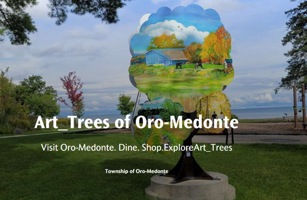
The future for Oro-Medonte and GIS holds many new and exciting projects, with an emphasis on interactivity. Indeed, Paul and Oro-Medonte have been rapidly building new applications. This includes another StoryMap called “Art Trees of Oro-Medonte”, a program involving the installation of large painted metal tree sculptures that will boost tourism on behalf of the Township’s economic development program.
The Township is also working on construction of their very own ArcGIS GeoHub, as well as plans to build newer maps and applications to replace outdated ones on the Township’s website.
With their Development Services Planning department, they will incorporate their newly approved Official Plan Map Schedules into an interactive map with the ability to explore pop-ups and hyperlinks as desired. The City of Orangeville inspired them to build an ArcGIS Dashboard using the Community Map of Canada basemaps to show planning applications. The “Planning Application Dashboard” will create better customer service relationships between the planners and the public, as responding to application inquiries usually takes a lot of effort from the staff.
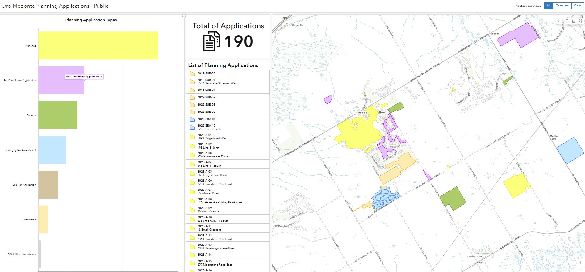
While talking with Paul, he commented on how GIS factors into Oro-Medonte's planning: “Every month, we have a development services committee to review up-and-coming projects; this lets us see the status both visually and geographically. This creates better customer service relationships between the planners and the public, and saves time for the planners, helping them prepare mapping schedules.”
For those GIS experts not sure where to get started on mapping and building applications for their communities, Paul advises them the following,
“Take a look at your municipality’s old maps on their website, physical copies and talk to your CAO, managers and directors of different departments to share how you can improve their ‘old’ maps. Bring up the Community Map program in your first staff meeting and explain how you can get the municipality ‘on the map’ by showing that you can make the Topographic basemap better than before which can make a huge difference in the long term.”