Mapping our History: ArcGIS resources for Remembrance Day
Remembrance Day is a time to honour the sacrifices of those who served in the armed forces. In this post, you will explore a range of ArcGIS resources that can deepen discussions about Canada’s military contributions, including its role in the World Wars. These tools will help you guide students in reflecting on the profound impact of service, sacrifice, and remembrance in our nation’s history.
Primary source documents, such as photographs, paintings, and letters from battles and the World Wars, provide invaluable insights into the personal experiences of those who lived through these pivotal moments. By mapping these materials with ArcGIS, you can highlight key events, locations, and the lives of soldiers, bringing historical narratives to life in a dynamic way.
As Remembrance Day approaches, explore the ArcGIS resources designed to help your students engage with this rich history. Through step-by-step tutorials, the students will learn how to create your own content that visually represent the stories of sacrifice, courage, and resilience that shaped Canada’s military legacy. These tools will empower students to connect with the past in a meaningful and impactful way.
Remembering The Battle of Vimy Ridge Lesson
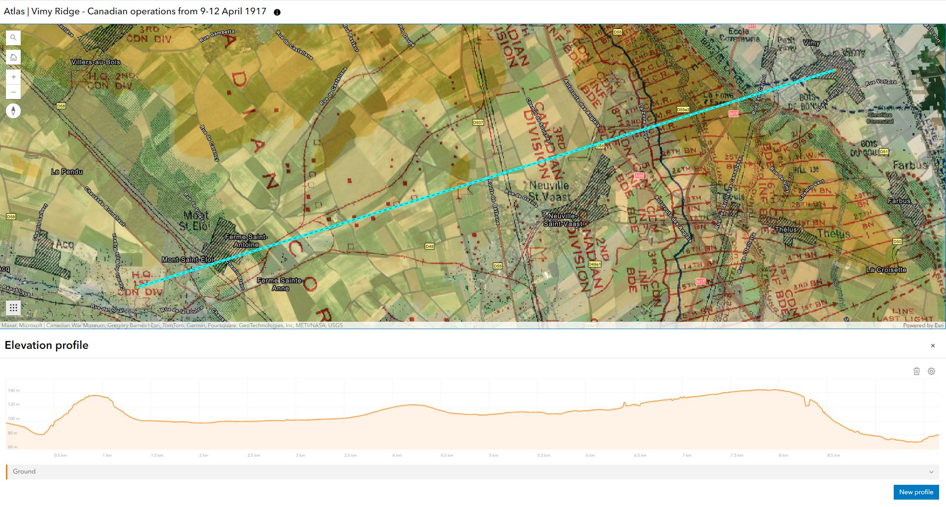
In this NEWLY UPDATED lesson, students will use ArcGIS to gain a deeper understanding of the Battle of Vimy Ridge during World War I. They will measure and trace the movements of Canadian troops during the battle, mark important features of the battlefield, and analyse the region’s elevation and geography, enhancing their understanding of this significant historic event.

In this lesson, students will create an elevation profile of the Vimy Ridge region to gain a deeper understanding of why this area was a significant location in World War I.
Story Maps
Remembrance Day is a time of reflection and learning. Consider creating a story map using primary source documents to tell a story that’s connected to a historic event. A great example of this was created in 2016 by Robert Alldritt, a former Esri Canada employee.
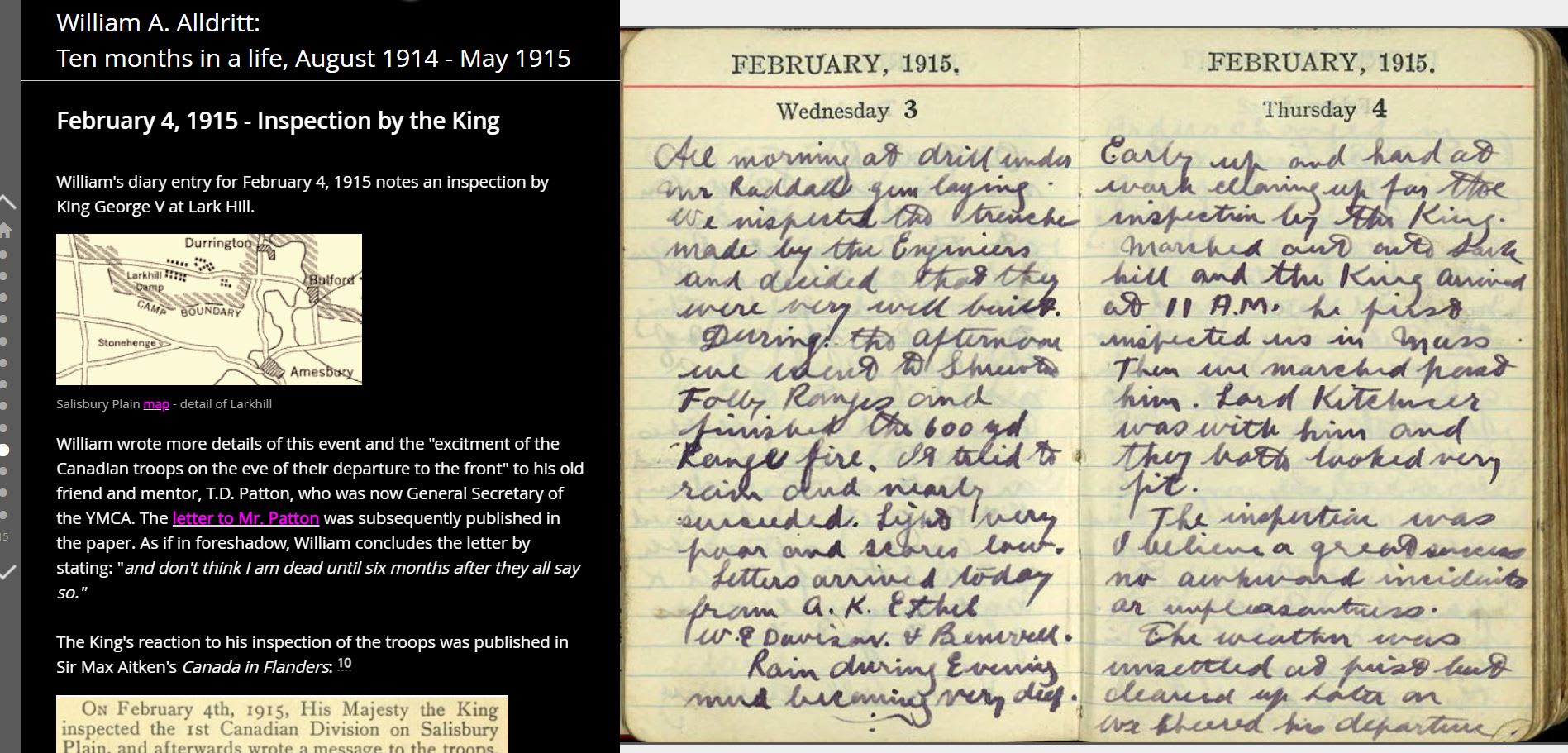
William A. Alldritt: Ten months in a life, August 1914 - May 1915
This story map highlights some of the primary source documents Robert discovered from his grandfather’s life during WWI.

William's diary entry for February 4, 1915, notes an inspection by King George V at Lark Hill.
Sargent Peter Samson
This story map highlights Sargent Peter Samson who was involved in World War I. He joined the First Newfoundland Regiment on September 2, 1914, at the age of 21.
Resurfacing the Past
Explore this story map created by Paul Heersink - a cartographer and Program Manager of Esri Canada’s Roads & Addresses Program. More than 20,000 ships sank during World War II. One man is on a mission to map them all — and is uncovering untold stories along the way. Check out his Sunken Ships of the Second World War ArcGIS Dashboard and the Esri Canada Geographical Thinking Podcast about the mapping of sunken war ships, published November 3, 2022
Juno Stories Story Maps
Defining Moments Canada is one of Esri Canada’s Partners in Education that created a series of ArcGIS StoryMaps to highlight their Juno Stories project. Each story map is viewable within the collection, but also independently in each section of the project (D-Day, Battle of Normandy, Serve Supply and Support, and D-Day Dodgers).
Story Map Resources
You and your students can create your own story maps. Use the tutorials below to learn how.
Note: If you do not have an ArcGIS Online account, go to the last section in this post to sign up.
Discover Story Maps
Use this tutorial to see the step-by-step instructions and videos on how to create your first story map.
Taking Story Maps to the Next Level
Learn how to make your storytelling more engaging and interactive in this tutorial.
Ideas to create your own Remembrance Day story map:
Inspired to get started with ArcGIS Online?
K-12 educators can sign up today at k12.esri.ca. Begin your journey with the following resources:
Let’s get started with ArcGIS Online
Self-guided learning for K-12 educators
ArcCanada Atlas Activity Collection NEW resource
Explore and understand national and global geography, history, and culture through interactive activities and create maps.