K-12 GIS Day Adventures in 2024
Discover how K-12 students in Canada celebrate GIS Day and Geography Awareness Week through hands-on workshops and presentations. These events help to unlock the power of mapping and spatial thinking! Through interactive tools and real-world applications, students are exploring, analyzing, and visualizing the world, gaining valuable skills for the future.
GIS Day is an annual event held in November that celebrates the impact of geographic information systems (GIS), a spatial technology used to solve real-world problems and inspire innovation. The special day occurs during Geography Awareness Week – a time to promote geographic literacy through educational activities and events.

Geography Awareness Week and GIS Day are special days to celebrate the power of geography and mapping! This year, GIS Day was held on November 20th.
The K-12 group supports GIS Ambassadors and K-12 educators in coordinating GIS Day and Geography Awareness Week related events throughout the year, even when they occur outside the designated dates.
Here are some past and future events in 2024:
Shahrooz Pirkoohi, Tłı̨chǫ Government
GIS Coordinator and GIS Ambassador
Northwest Territories
On GIS Day, November 20th, Shahrooz worked with high school students in Edzo, Behchokǫ̀ on how to use ArcGIS Online to create story maps and maps to monitor local freshwater and wildlife. Over the semester, students are developing a web map of Tłı̨chǫ lands (39,000 km²) in the Northwest Territories, highlighting winter roads, traditional trails, and Tłı̨chǫ communities. They will also learn how to create a field map to support wildlife monitoring along the newly constructed highway in the region. The school serves the Tłı̨chǫ Dene First Nations community and is located about 15 km south of Rae, Behchoko.
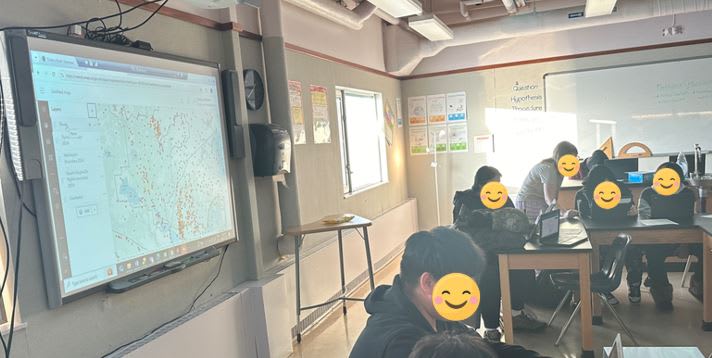 Students from Northwest Territories engaged in their learning of ArcGIS Online.
Naiomi Borger, Fractional Analytics Consultant
GIS Ambassador, Saskatchewan
During Geography Awareness Week, Naiomi presented to a couple of elementary schools in Regina. She discussed the timelines and evolution of GIS and how this technology functions within the world of STEM (Science, Technology, Engineering, and Mathematics). STEM refers to an educational approach that integrates these disciplines to promote critical thinking, problem-solving, and innovation.
Amit Arora, Durham College
Professor and GIS Ambassador, Ontario
In late November, Amit will be facilitating a couple of workshops for a school in Markham, Ontario to show the grade 9 students the possibilities of GIS in K-12, Higher education and the real-world. The students will have an opportunity to work on an ArcCanada Atlas activity.
Stephanie Steele, Planner, Burlington Transit
Anthony Campese, Supervisor of Geomatics, City of Burlington
GIS Ambassadors, Ontario
In November, Stephanie and Anthony facilitated a couple of workshops at a high school in Burlington, Ontario. The teacher wanted the students to learn how to access data in ArcGIS Online to look at the topics of sustainable communities and watersheds. The K-12 group at Esri Canada prepared a workshop presentation and activity for them to use for this event.
Jean Tong, Esri Canada
K-12 Program Manager
On Friday November 22nd, Jean facilitated ArcGIS workshops for the Canadian and World Studies teachers at the Hamiliton Wentworth District School Board that included ArcCanada Atlas and ArcGIS StoryMaps.
K-12 events hosted by universities
Arabelle Sauvé, Esri Canada
K-12 Education Specialist
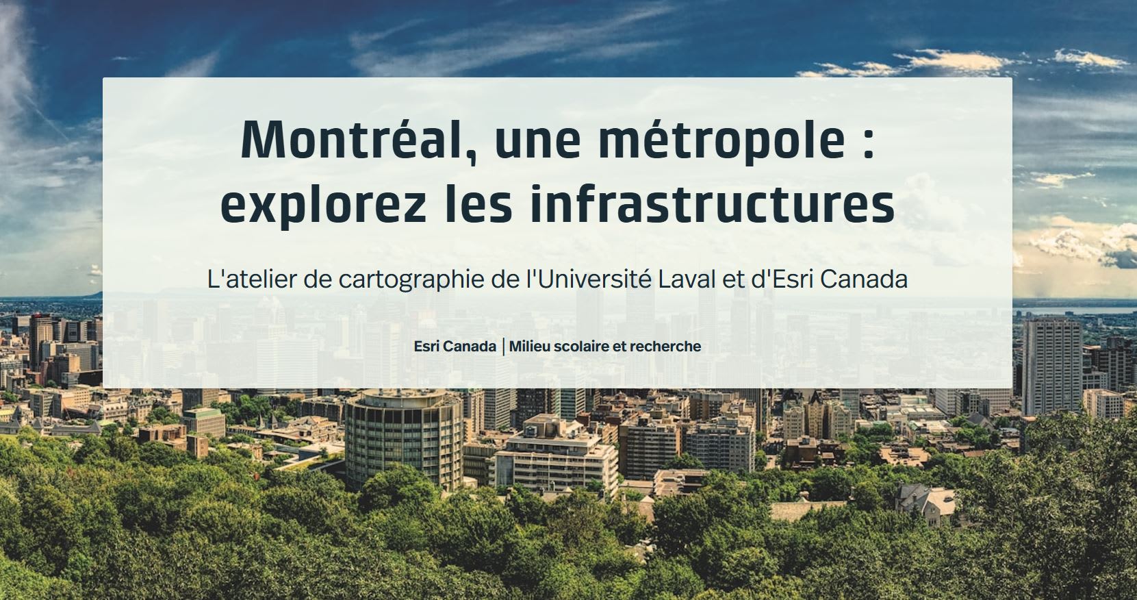
On October 17th, Arabelle supported the Universtié Laval’s Geography Department in a virtual ArcGIS Online workshop for students at a private secondary school in Quebec City.
Students learned about ArcGIS Online and had an opportunity to try it during the virtual workshop.
York University GIS Day
The Faculty of Environmental & Urban Change (EUC) at York University hosted a hybrid GIS Day 2024 event on November 20th, welcoming high school students (grades 9–12) and the York community to explore the transformative world of Geographic Information Systems (GIS). This event highlighted the innovative ways GIS can address real-world challenges, inspiring the next generation of future changemakers.
Attendees enjoyed engaging talks from EUC faculty on topics such as:
- Spaces of engagement in Toronto schools.
- River flow measurements with advanced velocimetry.
- Hydrological modeling of Black Creek.
- Modern georeferencing technology.
A standout feature was the interactive augmented reality sandbox, thanks to a partnership with the Toronto and Region Conservation Authority. This hands-on experience brought topographical modelling to life.
Patrick Deluca (Pat), McMaster University
GIS Specialist, Lecturer and Instructional Assistant
Jean Tong, Esri Canada
K-12 Program Manager
Pat and Jean will be facilitating ArcGIS workshops at McMaster University’s GIS Day for high schoolers on December 6th.
GIS Day in Canada
Esri Canada
A special GIS Day in Canada event was organized by Esri Canada on November 19th. At the event, Cynthia Bettio, a geography teacher at St. Katharine Drexel Catholic High School in Stouffville, Ontario was honoured with the Making a Difference award for her work in community building with ArcGIS. Watch this video to learn more about the grade 9 geography classes’ project with the Town of Stouffville’s Planning department.
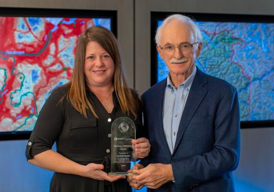
During the GIS Day in Canada event, Cynthia was presented with the Making a Difference Award by Alex Miller, President of Esri Canada.
GIS Ambassador support
Are you a K-12 educator planning a workshop or require help with a project? Well, you can request a GIS Ambassador to support you in the New Year.
Inspired to get started with ArcGIS Online?
K-12 educators can sign up today at k12.esri.ca. Begin your journey with the following resource:
Let’s get started with ArcGIS Online
Self-guided learning for K-12 educators
Happy Mapping!🌎