What is the impact of data centers on property valuations?
Data centers are expanding rapidly, raising questions about their impact on nearby property values. We discuss how GIS can measure real market effects.
View
Data centers are expanding rapidly, raising questions about their impact on nearby property values. We discuss how GIS can measure real market effects.
View
See how the Kentucky Department of Revenue transformed fragmented property sketches into a unified GIS-based approach.
View
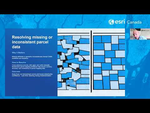
GIS managers can ensure a successful Computer Assisted Mass Appraisal (CAMA) migration by prioritizing deep data cleansing, establishing robust spatial validation and fostering cross-functional collab
Watch Video
Learn how GIS professionals improve data accuracy, streamline workflows and reduce risks to help assessor offices succeed in their CAMA conversions.
View
With ISO-certified information security, cloud protection and privacy systems and practices, you can rely on our solutions.
View
GIS-centric solution gives assessors powerful spatial visualization, editing and valuation capabilities for faster, more accurate property valuations
View
Turn paper sketches into sketches that are now viewable, useable GIS enabled property sketches.
View
In this webinar, you will learn how Texas Appraisal District is leveraging Esri Canada’s sketch verification and editing tools to improve efficiency, streamline workflows and enhance accuracy—featurin
Watch Video
GeoSketch modernizes property sketching with geo-referenced tools, improving accuracy, collaboration and real-world alignment for assessors.
View
Where can blockchain technology fit in the assessment industry?
View
With technological advancements and evolving stakeholder expectations, the assessment industry is transforming. Attend this webinar for insights on how you can anticipate and embrace these significant
Watch Video
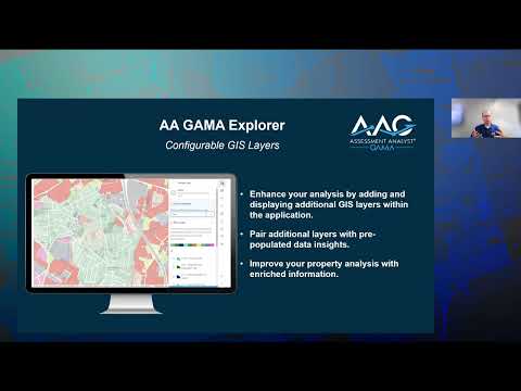
Discover GAMA's three subscriptions: GAMA Explorer for spatial insights, GAMA Editor for data management, and GAMA Evaluator for an integrated property assessment solution. Attendees will learn to emp
Watch Video
Read this blog post to understand what is blockchain, different types of blockchains and use cases of blockchain within government.
View
ArcGIS Pro, our premier desktop GIS solution, has transformed how you’ve been managing your maps for almost a decade. This webinar is the second in our Embracing ArcGIS Pro series, designed to show ho
Watch Video
Cloud-based geographic-assisted mass appraisal system enables quicker, equitable and defensible property valuations
View
Powerful web-based application enables assessors to easily identify data inconsistencies and valuation errors
View
To discover our suite of solutions for property assessment, click here: https://www.esri.ca/en-ca/solutions/industries/land-property/segments/property-assessment
Watch Video
Identify and resolve property changes and sketch measurement errors using professional services that support IAAO standards for mass appraisal
View
Assessment Analyst® - GAMA binds the power of CAMA and GIS so you can combine spatial data with advanced analysis, resulting in quicker, more equitable and defensible valuations. Visit esri.ca/gama T
Watch Video
Marcy Martin, real property tax administrator for the County of Maui in Hawaii, shares how the County has improved the quality of property inspections and increased productivity with Esri Canada’s Ass
Watch Video
Loading More...